Southend-on-Sea
 | |||
| |||
| Alministración | |||
| País | |||
| Nación constitutiva | |||
| Rexón | Este d'Inglaterra | ||
| Condáu ceremonial | Essex | ||
| Área (es) | Southend-on-Sea (en) | ||
| Tipu d'entidá |
zona no parquizada (es) | ||
| Códigu postal |
SS1, SS2, SS22, SS3 y SS99 | ||
| Xeografía | |||
| Coordenaes | 51°32′16″N 0°42′50″E / 51.53789°N 0.71377°E | ||
| Superficie | 41.76 km² | ||
| Demografía | |||
| Población | 160 257 hab. (2011) | ||
| Porcentaxe |
100% de Southend-on-Sea (en) 8.63% de Essex 0% de Este d'Inglaterra 0% de Inglaterra 0.24% de Reinu Xuníu | ||
| Densidá | 3837,57 hab/km² | ||
| Más información | |||
| Estaya horaria | UTC±00:00 | ||
| southend.gov.uk | |||
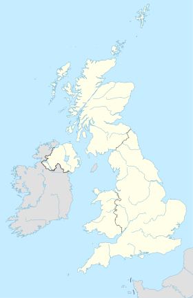
Southend-on-Sea (![]() /ˌsaʊθˈɛnd-siː/ (?·i)) ye una autoridá unitaria y ciudá nel condáu ceremonial d'Essex, Inglaterra.[1][2] Distritu con categoría de conceyu y entiende les poblaciones de Chalkwell, Eastwood, Leigh-on-Sea, North Shoebury, Prittlewell, Shoeburyness, Southchurch, Thorpe Bay y Westcliff-on-Sea. Ta asitiáu na zona del Thames Gateway, del llau norte del estuariu del Támesis, 64 km al este del centru de Londres. Ta arrodiáu pel norte por Rochford y pel oeste por Castle Point. En Southend atópase'l muelle más llargu del mundu, conocíu como Southend Pier.[3] Por población, ye la 36ª ciudá del Reinu Xuníu, con 164.300 habitantes censaos.
/ˌsaʊθˈɛnd-siː/ (?·i)) ye una autoridá unitaria y ciudá nel condáu ceremonial d'Essex, Inglaterra.[1][2] Distritu con categoría de conceyu y entiende les poblaciones de Chalkwell, Eastwood, Leigh-on-Sea, North Shoebury, Prittlewell, Shoeburyness, Southchurch, Thorpe Bay y Westcliff-on-Sea. Ta asitiáu na zona del Thames Gateway, del llau norte del estuariu del Támesis, 64 km al este del centru de Londres. Ta arrodiáu pel norte por Rochford y pel oeste por Castle Point. En Southend atópase'l muelle más llargu del mundu, conocíu como Southend Pier.[3] Por población, ye la 36ª ciudá del Reinu Xuníu, con 164.300 habitantes censaos.
Referencies[editar | editar la fonte]
- ↑ Office for National Statistics. «United Kingdom: Counties and Unitary Authorities» (inglés). Consultáu'l 24 de febreru de 2013.
- ↑ Office for National Statistics. «Counties, Non-metropolitan Districts and Unitary Authorities» (inglés). Consultáu'l 24 de febreru de 2013.
- ↑ (2009) David Else: England, 5ª, Lonely Planet, páx. 445. ISBN 1741045908.
Enllaces esternos[editar | editar la fonte]


