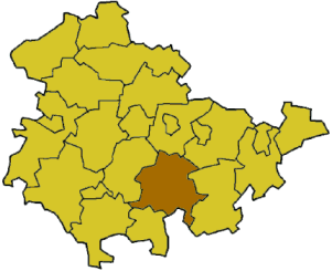
Distritu de Saalfeld-Rudolstadt
| Armes | Mapa |
|---|---|

|

|
| Datos Básicos | |
| Bundesland: | Turinxa |
| Capital de distritu: | Saalfeld/Saale |
| Superficie: | 1.034,58 km² |
| Habitantes: | 124.369 (30 de xunu de 2006) |
| Densidá de población: | 120 Habitantes per km² |
| Códigu de distritu: | 16 0 73 |
| Matrícula: | SLF |
| Composición: | 43 Gemeinden |
| Direición de la Alministración: |
Schloßstraßy 24 07318 Saalfeld/Saale |
| Website: | www.sa-ru.de |
| Mapa de distritu | |

| |
El Distritu de Saalfeld-Rudolstadt (n'alemán: Landkreis Saalfeld-Rudolstadt) ye un distritu rural (Landkreis) allugáu al sur del estáu federal de Turinxa (Alemaña). La capital del distritu ye la ciudá de Saalfeld/Saale.
Xeografía[editar | editar la fonte]
Los territorios vecinos al norte son el Distritu de Weimarer Land, al noroeste'l Saale-Holzland-Kreis, al este'l Saale-Orla-Kreis, na parte meridional el distritu de Kronach y el distritu de Sonneberg, al sureste el distritu de Hildburghausen y al oeste'l Ilm-Kreis. El distritu de Saalfeld-Rudolstadt tien como ríos importantes que crucien los sos dominios el Saale na contorna del Thüringer Schiefergebirge.
Composición de Distritu[editar | editar la fonte]
(Población a 30 de xunu de 2006)
Ciudaes[editar | editar la fonte]
- Bad Blankenburg (7.441)
- Gräfenthal (2.674)
- Königsee (5.484)
- Lehesten (2.092)
- Leutenberg (2.491)
- Oberweißbach/Thür. Wald (1.633)
- Remda-Teichel (3.268)
- Rudolstadt (25.268)
- Saalfeld/Saale ² (27.861)
Conceyos[editar | editar la fonte]
³ Municiìos de rellenu
- Arnsgereuth (Ciudá Saalfeld/Saale) (252)
- Kamsdorf (2.932)
- Kaulsdorf, (2.944), Conceyos de rellenu para:
- Altenbeuthen (252)
- Drognitz (690)
- Hohenwarte (141)
- Rottenbach (1.996)
- Saalfelder Höhe (3.448)
- Uhlstädt-Kirchhasel, (5.663), Conceyos de rellenu para:
- Großkochberg (687)
- Heilingen (335)
- Unterwellenborn (6.637)
Agrupaciones Alministratives[editar | editar la fonte]
|
4. Probstzella-Lehesten-Marktgölitz
|
Ver tamién[editar | editar la fonte]
Referencies[editar | editar la fonte]
Enllaces esternos[editar | editar la fonte]
50°40′N 11°20′E / 50.67°N 11.33°E
