
Ficheru:Tirol 1918.png
Tamañu d'esta previsualización: 796 × 600 pixels. Otres resoluciones: 319 × 240 pixels | 637 × 480 pixels | 1019 × 768 pixels | 1280 × 965 pixels | 1502 × 1132 pixels.
Ficheru orixinal (1502 × 1132 píxels, tamañu de ficheru: 193 kB, triba MIME: image/png)
Resume
| Descripción |
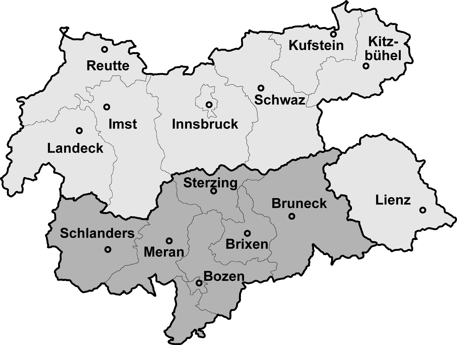
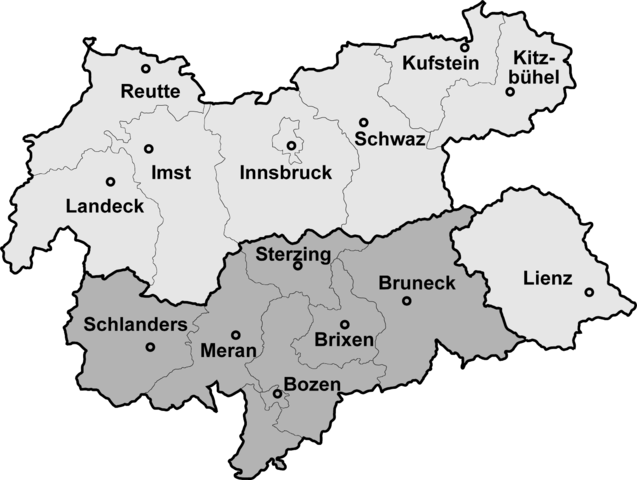
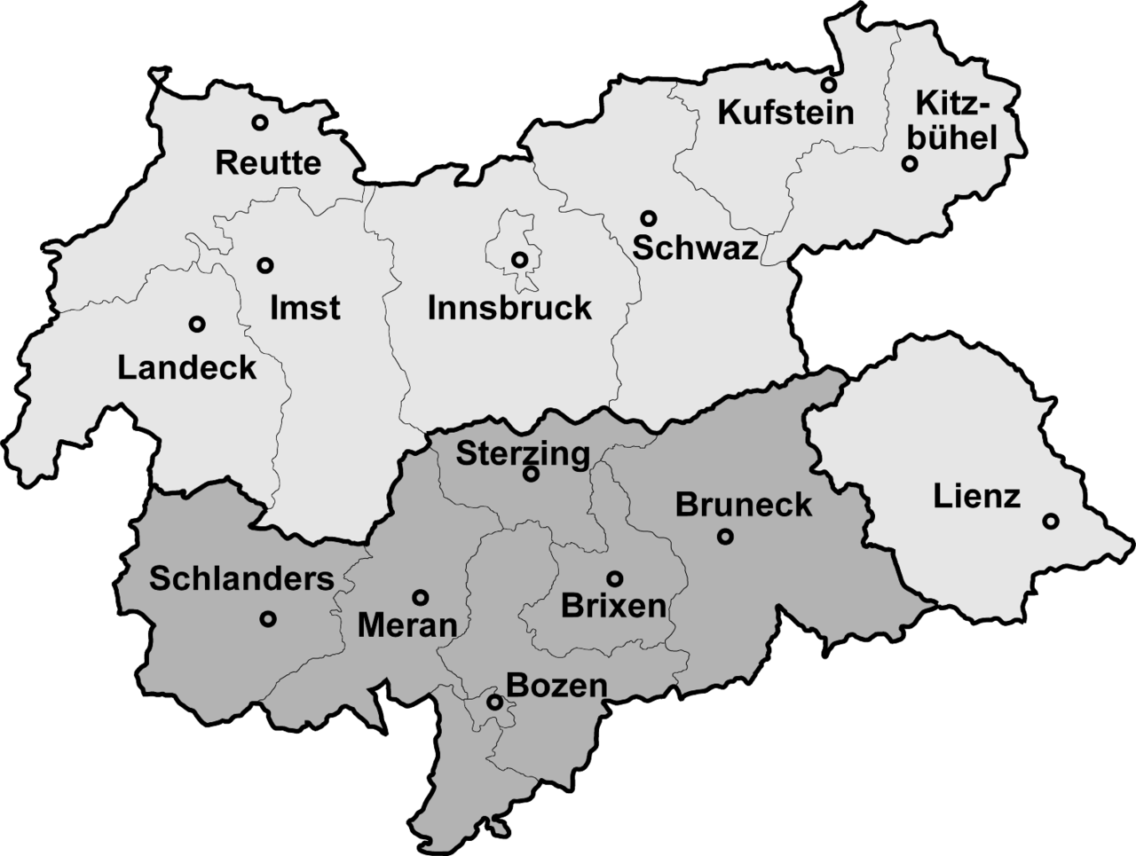
Map of North, South and Eastern Tirol with district borders Deutsch: Isolierte Lage des Bezirks Lienz (Osttirol) nach der Abtrennung Südtirols (dunkelgrau) 1918
English: Tyrol after 1918, the southern part is now a part of Italy
Português: Mapa do Tirol com a divisão de 1918 que o dividiu entre Áustria (parte setentrional) e Itália (parte meridional) |
|||
| Data | 4 de febreru de 2006 (fecha de carga) | |||
| Fonte | Map drawn by (Geiserich77) | |||
| Autor | Geiserich77 | |||
| Otres versiones |
|


|
Autorízase la copia, distribución y/o cambéu d'esti documentu baxo los términos de la Llicencia de documentación llibre GNU, versión 1.2 o cualesquier otra que nel futuru espublice la Free Software Foundation; ensin seiciones invariables, testos de portada, nin testos de contraportada. S'inclúi una copia de la llicencia na seición titulada GNU Free Documentation License. |
| Esti ficheru ta disponible baxo la llicencia Creative Commons Reconocimientu-Compartir igual 3.0 xenérica. | ||
| ||
| Esta etiqueta de llicencia s'amestó a esti ficheru como parte del anovamientu de la llicencia GFDL. |
Historial del ficheru
Calca nuna fecha/hora pa ver el ficheru como taba daquella.
| Data/Hora | Miniatura | Dimensiones | Usuariu | Comentariu | |
|---|---|---|---|---|---|
| actual | 12:10 4 feb 2006 | | 1502 × 1132 (193 kB) | Geiserich77 | == Beschreibung == {{Information| |Description = Map of North, South and Eastern Tirol with district borders |Source = Map drawn by (Geiserich77) |Date = 29.01.2006 |Author = Geiserich77 |Permission = GNU FDL |oth |
| 13:49 29 xin 2006 |  | 1598 × 1248 (197 kB) | Geiserich77 | {{Information| |Description = Map of North, South and Eastern Tirol with district borders |Source = Map drawn by (Geiserich77) |Date = 29.01.2006 |Author = Geiserich77 |Permission = GNU FDL |other_versions = - }} |
Usu del ficheru
La páxina siguiente usa esti ficheru:
Usu global del ficheru
Estes otres wikis usen esti ficheru:
- Usu en an.wikipedia.org
- Usu en br.wikipedia.org
- Usu en cs.wikipedia.org
- Usu en eo.wikipedia.org
- Usu en es.wikipedia.org
- Usu en fi.wikipedia.org
- Usu en hu.wikipedia.org
- Usu en is.wikipedia.org
- Usu en ja.wikipedia.org
- Usu en lmo.wikipedia.org
- Usu en nds-nl.wikipedia.org
- Usu en nl.wikipedia.org