
Ficheru:North Atlantic Ocean laea relief location map.jpg

Tamañu d'esta previsualización: 739 × 599 pixels. Otres resoluciones: 296 × 240 pixels | 592 × 480 pixels | 947 × 768 pixels | 1181 × 958 pixels.
Ficheru orixinal (1181 × 958 píxels, tamañu de ficheru: 1,13 MB, triba MIME: image/jpeg)
Resume
| Descripción |
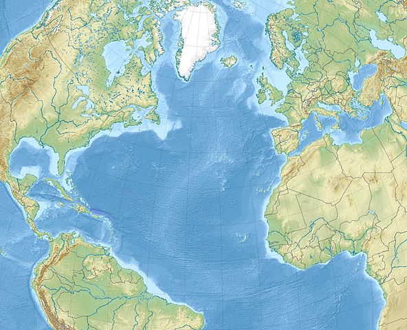
English: Relief location map of North_Atlantic_Ocean.
|
| Data | |
| Fonte | Trabayu propiu |
| Autor | Uwe Dedering |
Llicencia
Yo, el titular de los drechos d'autor d'esta obra, la espublizo baxo les siguientes llicencies:
Esti ficheru ta disponible baxo la llicencia Creative Commons Reconocimientu-Compartir igual 3.0 xenérica.
- Ye llibre:
- pa compartir – pa copiar, distribuir y comunicar públicamente la obra
- pa remezclar – p'adautar la obra
- Baxo les condiciones siguientes:
- reconocimientu – Tienes de dar el créitu apropiáu, apurrir un enllaz a la llicencia ya indicar si realizasti dalgún cambéu. Puedes faelo de cualquier mou razonable ,pero non de manera que suxera l'encontu del autor pa ti o pal usu que faigas.
- compartir igual – Si entemeces, tresformes o te bases nesti material, tienes de distribuir les tos contribuciones baxo la mesma llicencia o una compatible cola orixinal.

|
Autorízase la copia, distribución y/o cambéu d'esti documentu baxo los términos de la Llicencia de documentación llibre GNU, versión 1.2 o cualesquier otra que nel futuru espublice la Free Software Foundation; ensin seiciones invariables, testos de portada, nin testos de contraportada. S'inclúi una copia de la llicencia na seición titulada GNU Free Documentation License. |
Pues seleicionar la llicencia que prefieras.
Historial del ficheru
Calca nuna fecha/hora pa ver el ficheru como taba daquella.
| Data/Hora | Miniatura | Dimensiones | Usuariu | Comentariu | |
|---|---|---|---|---|---|
| actual | 11:20 4 avi 2010 | | 1181 × 958 (1,13 MB) | Uwe Dedering | {{Information |Description={{en|1= Relief location map of North_Atlantic_Ocean. * Projection: Lambert azimuthal equal-area projection. * Area of interest: :* N: 80.0° N :* S: -10.0° N :* W: -90.0° E :* E: 20.0° E * Projection center: :* NS: 35.0° N : |
Usu del ficheru
Les páxines siguientes usen esti ficheru:
Usu global del ficheru
Estes otres wikis usen esti ficheru:
- Usu en ar.wikipedia.org
- Usu en az.wikipedia.org
- Usu en be-tarask.wikipedia.org
- Usu en be.wikipedia.org
- Usu en ceb.wikipedia.org
- Usu en ce.wikipedia.org
- Usu en ckb.wikipedia.org
- Usu en de.wikipedia.org
- Usu en el.wikipedia.org
- Usu en en.wikipedia.org
- Strait of Gibraltar
- Panama City
- Eglin Air Force Base
- Tyndall Air Force Base
- McGuire Air Force Base
- Beerenberg
- Glorious First of June
- Bogotá
- Ilulissat
- Naval Air Station Joint Reserve Base Willow Grove
- Paradise Island
- HX convoys
- Gulf of Maine
- Hurlburt Field
- Abaco Islands
- RAF Mildenhall
- SS Ceramic
- Saint Helena Island (South Carolina)
- Jupiter Island
Ver más usos globales d'esti ficheru.