
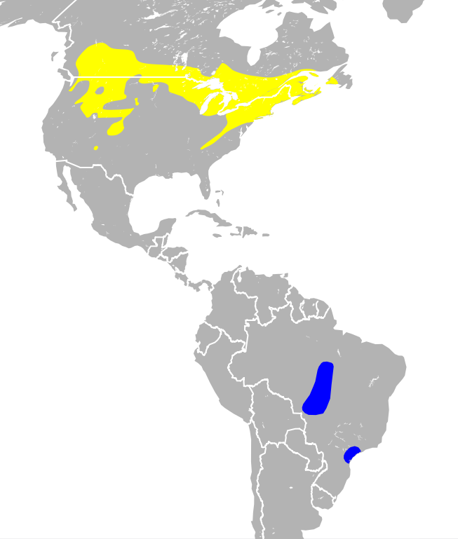
Ficheru:Catharus fuscescens map.svg

Tamañu de la vista previa PNG d'esti ficheru SVG: 301 × 354 pixels. Otres resoluciones: 204 × 240 pixels | 408 × 480 pixels | 653 × 768 pixels | 871 × 1024 pixels | 1741 × 2048 pixels.
Ficheru orixinal (ficheru SVG, 301 × 354 píxels nominales, tamañu de ficheru: 2,12 MB)
Resume
| Descripción | |
| Data | |
| Fonte |
|
| Autor | Stongey |
Llicencia
Yo, el titular de los drechos d'autor d'esta obra, la espublizo baxo la siguiente llicencia:
Esti ficheru ta disponible baxo la llicencia Creative Commons Reconocimientu-Compartir igual 3.0 xenérica.
- Ye llibre:
- pa compartir – pa copiar, distribuir y comunicar públicamente la obra
- pa remezclar – p'adautar la obra
- Baxo les condiciones siguientes:
- reconocimientu – Tienes de dar el créitu apropiáu, apurrir un enllaz a la llicencia ya indicar si realizasti dalgún cambéu. Puedes faelo de cualquier mou razonable ,pero non de manera que suxera l'encontu del autor pa ti o pal usu que faigas.
- compartir igual – Si entemeces, tresformes o te bases nesti material, tienes de distribuir les tos contribuciones baxo la mesma llicencia o una compatible cola orixinal.

|
Hace falta corroborar las categorías de esta imagen. ¡Inténtalo ahora!
|
Historial del ficheru
Calca nuna fecha/hora pa ver el ficheru como taba daquella.
| Data/Hora | Miniatura | Dimensiones | Usuariu | Comentariu | |
|---|---|---|---|---|---|
| actual | 17:36 12 pay 2013 | | 301 × 354 (2,12 MB) | Stongey | used a simpler country outline file to reduce file size. Hadn't realize just how big the original file was. Will continue to experiment with reducing file size export out of QGIS. |
| 03:55 12 pay 2013 |  | 301 × 354 (4,1 MB) | Stongey | User created page with UploadWizard |
Usu del ficheru
La páxina siguiente usa esti ficheru:
Usu global del ficheru
Estes otres wikis usen esti ficheru:
- Usu en arz.wikipedia.org
- Usu en br.wikipedia.org
- Usu en ca.wikipedia.org
- Usu en ceb.wikipedia.org
- Usu en cy.wikipedia.org
- Usu en en.wikipedia.org
- Usu en eo.wikipedia.org
- Usu en es.wikipedia.org
- Usu en eu.wikipedia.org
- Usu en fr.wikipedia.org
- Usu en hu.wikipedia.org
- Usu en nn.wikipedia.org
- Usu en nv.wikipedia.org
- Usu en pl.wikipedia.org
- Usu en species.wikimedia.org
- Usu en sv.wikipedia.org
- Usu en uk.wikipedia.org
- Usu en vi.wikipedia.org
- Usu en www.wikidata.org