
Ficheru:BlankMap-USA-states-Canada-provinces, HI closer.svg

Tamañu de la vista previa PNG d'esti ficheru SVG: 512 × 512 pixels. Otres resoluciones: 240 × 240 pixels | 480 × 480 pixels | 768 × 768 pixels | 1024 × 1024 pixels | 2048 × 2048 pixels.
Ficheru orixinal (ficheru SVG, 512 × 512 píxels nominales, tamañu de ficheru: 104 kB)
| Descripción |
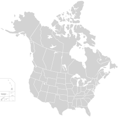
English: Blank SVG map of USA and Canada with state and province borders. Hawaii has been moved closer to the mainland USA to reduce width of image.
Non-contiguous parts of a states/provinces are "grouped" together with the main area of the state/provinces, so any state/provinces can be coloured in completion with one click anywhere on the state/provinces's area. Also, all states/provinces have a "id" attached to them, making them easy to find. Select "find" and then enter in the state/provinces's ISO 3166-2 code in the "id" field to find it. The codes can be found here (Canada) and here (USA). |
| Data | |
| Fonte |
El código fuente de esta imagen SVG es válido. Esta imagen vectorial fue creada con Inkscape, y luego editada manualmente . |
| Autor | Lokal_Profil |
| Permisu (Cómo reutilizar esti ficheru) |
Este archivo se encuentra bajo la licencia Creative Commons Genérica de Atribución/Compartir-Igual 2.5. Reconocimientu: Lokal_Profil
|
| Otres versiones |
Esta imagen vectorial incluye elementos que han sido tomados o adaptados de esta:
The same as this map with the two-letter state or province name label for each one |
Historial del ficheru
Calca nuna fecha/hora pa ver el ficheru como taba daquella.
| Data/Hora | Miniatura | Dimensiones | Usuariu | Comentariu | |
|---|---|---|---|---|---|
| actual | 01:48 23 pay 2020 | | 512 × 512 (104 kB) | Ponderosapine210 | Accidentally uploaded wrong version. Here is the correct one. |
| 01:38 23 pay 2020 |  | 512 × 596 (132 kB) | Ponderosapine210 | Added the prominent islands of Manitoulin (Ontario) and Isle Royale (Michigan) to the Great Lakes. | |
| 22:59 1 xun 2019 |  | 512 × 512 (99 kB) | Fluffy89502 | added territories | |
| 21:18 8 avi 2007 |  | 1730 × 1730 (212 kB) | Lokal Profil | Code trimming | |
| 04:21 3 xnt 2007 |  | 1730 × 1730 (213 kB) | Lokal Profil | {{Information |Description={{en|Blank SVG map of USA and Canada with state and province borders. Hawaii has been moved closer to the mainland USA to reduce width of image.}} Non-contiguous parts of a states/provinces are "grouped" together with the main a |
Usu del ficheru
Nun hai páxines qu'usen esti ficheru.
Usu global del ficheru
Estes otres wikis usen esti ficheru:
- Usu en en.wikipedia.org
- Usu en fr.wikipedia.org