
Ficheru:Basin and Range Province Boundaries and Landmarks.svg

Tamañu de la vista previa PNG d'esti ficheru SVG: 383 × 464 pixels. Otres resoluciones: 198 × 240 pixels | 396 × 480 pixels | 634 × 768 pixels | 845 × 1024 pixels | 1690 × 2048 pixels.
Ficheru orixinal (ficheru SVG, 383 × 464 píxels nominales, tamañu de ficheru: 324 kB)
O5/19/2023
Resume
| Descripción |
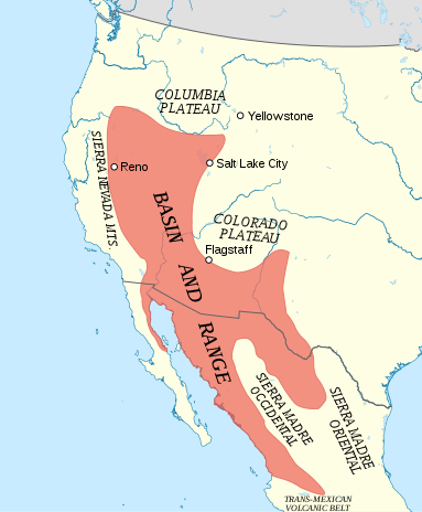
English: Map of the Basin and Range Province, including relevant landmarks. |
| Data | |
| Fonte | vectorización of w:File:Basin and Range Province Boundaries and Landmarks.jpg |
| Autor |
|
Llicencia
Este archivo se encuentra bajo la licencia Creative Commons Atribución 3.0 Unported.
- Ye llibre:
- pa compartir – pa copiar, distribuir y comunicar públicamente la obra
- pa remezclar – p'adautar la obra
- Baxo les condiciones siguientes:
- reconocimientu – Tienes de dar el créitu apropiáu, apurrir un enllaz a la llicencia ya indicar si realizasti dalgún cambéu. Puedes faelo de cualquier mou razonable ,pero non de manera que suxera l'encontu del autor pa ti o pal usu que faigas.
Historial del ficheru
Calca nuna fecha/hora pa ver el ficheru como taba daquella.
| Data/Hora | Miniatura | Dimensiones | Usuariu | Comentariu | |
|---|---|---|---|---|---|
| actual | 23:59 1 och 2018 | | 383 × 464 (324 kB) | AntiCompositeNumber | {{Information |description ={{en|1=Map of the Basin and Range Province, including relevant landmarks.}} |date =2018-10-01 |source ={{vectorization}} of w:File:Basin and Range Province Boundaries and Landmarks.jpg |author =* {{Original image}}: Kathleen Smith * {{Vectorization}}: AntiCompositeNumber }} {{Graphic Lab |1=en |2=map }} Category:Maps of Basin and Range Province |
Usu del ficheru
La páxina siguiente usa esti ficheru:
Usu global del ficheru
Estes otres wikis usen esti ficheru:
- Usu en ar.wikipedia.org
- Usu en de.wikipedia.org
- Usu en en.wikipedia.org
- Usu en ja.wikipedia.org
- Usu en ru.wikipedia.org
- Usu en tr.wikipedia.org
- Usu en www.wikidata.org