
Ficheru:The Diomede Islands in the BeringSea (picture from space).jpg
Tamañu d'esta previsualización: 750 × 600 pixels. Otres resoluciones: 300 × 240 pixels | 600 × 480 pixels | 900 × 720 pixels.
Ficheru orixinal (900 × 720 píxels, tamañu de ficheru: 66 kB, triba MIME: image/jpeg)
.jpg)
Resume
| Descripción |
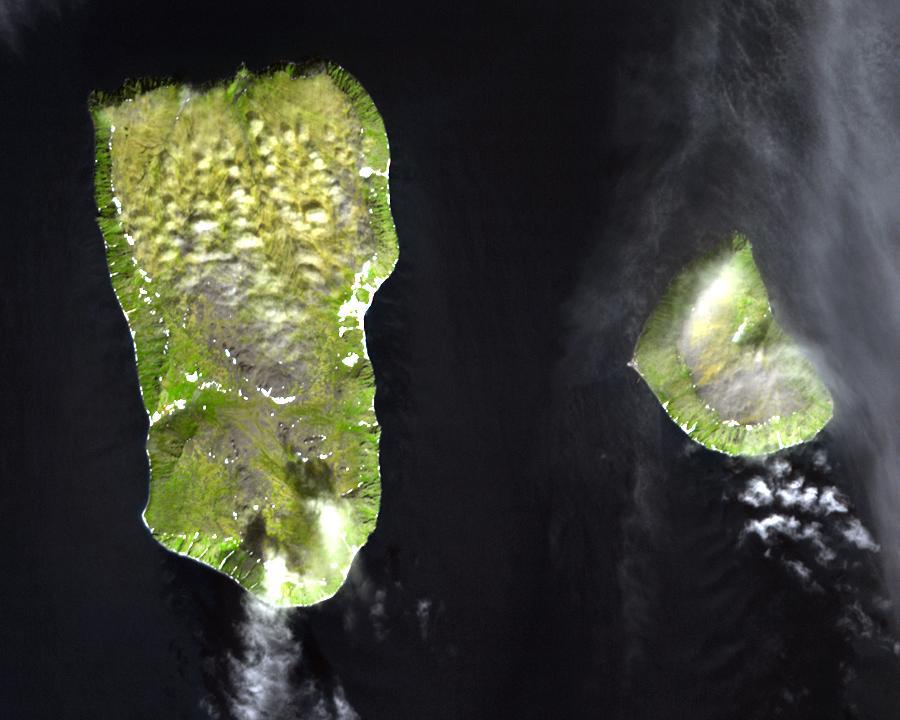
English: Diomede Islands in the middle of the Bering Strait:. The islands are separated by the border between Russia and the USA and by the International Date Line.
|
| Data | |
| Fonte |
|
| Autor | Desconocido |
| Permisu (Cómo reutilizar esti ficheru) |
This file is in the public domain because it was created by NASA. NASA copyright policy states that "NASA material is not protected by copyright unless noted". (NASA copyright policy page or JPL Image Use Policy). This image does not contain a NASA logo. |
Llicencia
| Este archivo es de dominio público porque fue creado por la NASA. Las políticas sobre copyright de la NASA estipulan que «el material de la NASA no está protegido con copyright a menos que se indique lo contrario». (Políticas sobre copyright de la NASA o Políticas sobre la utilización de imágenes del Jet Propulsion Laboratory). | ||
 |
Advertencias:
|
Historial del ficheru
Calca nuna fecha/hora pa ver el ficheru como taba daquella.
| Data/Hora | Miniatura | Dimensiones | Usuariu | Comentariu | |
|---|---|---|---|---|---|
| actual | 05:25 11 ago 2008 | | 900 × 720 (66 kB) | Micov | {{Information |Description={{en|1=The boarder between the USSR and the USA in the cold war. }} |Source=This file is in the public domain because it was created by NASA. NASA copyright policy stat |
Usu del ficheru
La páxina siguiente usa esti ficheru:
Usu global del ficheru
Estes otres wikis usen esti ficheru:
- Usu en af.wikipedia.org
- Usu en ar.wikipedia.org
- Usu en az.wikipedia.org
- Usu en be.wikipedia.org
- Usu en ca.wikipedia.org
- Usu en da.wikipedia.org
- Usu en de.wikipedia.org
- Usu en en.wikipedia.org
- Usu en es.wikipedia.org
- Usu en fi.wikipedia.org
- Usu en fr.wikipedia.org
- Usu en fr.wiktionary.org
- Usu en he.wikipedia.org
- Usu en hy.wikipedia.org
- Usu en id.wikipedia.org
- Usu en it.wikipedia.org
- Usu en ja.wikipedia.org
- Usu en mk.wikipedia.org
- Usu en nl.wikipedia.org
- Usu en pl.wikipedia.org
- Usu en ru.wikipedia.org
- Usu en simple.wikipedia.org
- Usu en sv.wikipedia.org
- Usu en tr.wikipedia.org
- Usu en vi.wikipedia.org
- Usu en www.wikidata.org
- Usu en zh.wikipedia.org
.jpg)