
Ficheru:Sweden Uppsala location map.svg

Tamañu de la vista previa PNG d'esti ficheru SVG: 460 × 599 pixels. Otres resoluciones: 184 × 240 pixels | 368 × 480 pixels | 589 × 768 pixels | 786 × 1024 pixels | 1572 × 2048 pixels | 842 × 1097 pixels.
Ficheru orixinal (ficheru SVG, 842 × 1097 píxels nominales, tamañu de ficheru: 381 kB)
Resume
| Descripción |
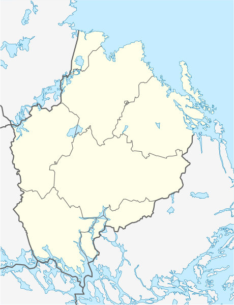
English: Location map of Uppsala county in Sweden
Equirectangular projection, N/S stretching 200 %. Geographic limits of the map:
Deutsch: Positionskarte von Uppsala län in Schweden
Quadratische Plattkarte, N-S-Streckung 200 %. Geographische Begrenzung der Karte:
|
| Data | |
| Fonte | Trabayu propiu |
| Autor | Erik Frohne |
Llicencia
Yo, el titular de los drechos d'autor d'esta obra, la espublizo baxo les siguientes llicencies:

|
Autorízase la copia, distribución y/o cambéu d'esti documentu baxo los términos de la Llicencia de documentación llibre GNU, versión 1.2 o cualesquier otra que nel futuru espublice la Free Software Foundation; ensin seiciones invariables, testos de portada, nin testos de contraportada. S'inclúi una copia de la llicencia na seición titulada GNU Free Documentation License. |
Este archivo se encuentra bajo la licencia Creative Commons Atribución 3.0 Unported.
- Ye llibre:
- pa compartir – pa copiar, distribuir y comunicar públicamente la obra
- pa remezclar – p'adautar la obra
- Baxo les condiciones siguientes:
- reconocimientu – Tienes de dar el créitu apropiáu, apurrir un enllaz a la llicencia ya indicar si realizasti dalgún cambéu. Puedes faelo de cualquier mou razonable ,pero non de manera que suxera l'encontu del autor pa ti o pal usu que faigas.
Pues seleicionar la llicencia que prefieras.
Historial del ficheru
Calca nuna fecha/hora pa ver el ficheru como taba daquella.
| Data/Hora | Miniatura | Dimensiones | Usuariu | Comentariu | |
|---|---|---|---|---|---|
| actual | 19:08 6 feb 2009 | | 842 × 1097 (381 kB) | Erik Frohne | {{Information |Description={{en|1=Location map of Uppsala county in Sweden Equirectangular projection, N/S stretching 200 %. Geographic limits of the map: * N: 60.80° N * S: 59.30° N * W: 16.60° E * E: 18.90° E}} {{de|1=Positionskarte von Uppsala l� |
Usu del ficheru
Les páxines siguientes usen esti ficheru:
Usu global del ficheru
Estes otres wikis usen esti ficheru:
- Usu en ar.wikipedia.org
- Usu en bg.wikipedia.org
- Usu en ceb.wikipedia.org
- Usu en cs.wikipedia.org
- Usu en da.wikipedia.org
- Usu en de.wikipedia.org
- Uppsala
- Forsmark
- Sävja
- Storvreta
- Knivsta
- Östhammar
- Enköping
- Bålsta
- Grillby
- Fjuckby
- Öregrund
- Tierp
- Heby
- Skutskär
- Wikipedia:Kartenwerkstatt/Positionskarten/Europa
- Älvkarleby
- Vorlage:Positionskarte Schweden Uppsala
- Alsike
- Gräsö
- Bergwerk Dannemora
- Järlåsa
- Slottsskogen
- Örbyhus
- Tallmossen
- Militärflugplatz Uppsala-Ärna
- Österbybruk
- Örskär
- Lövstabruk
- Studenternas IP
- Danmark (Uppsala)
- Benutzer:Stefan/Gottsunda
- Usu en en.wikipedia.org
Ver más usos globales d'esti ficheru.