
Ficheru:Solomon Islands adm location map.svg

Ficheru orixinal (ficheru SVG, 1890 × 1097 píxels nominales, tamañu de ficheru: 148 kB)
Resume
| Descripción |
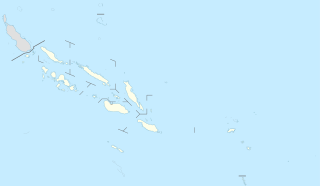
Deutsch: Positionskarte der Salomonen
English: Location map of the Solomon Islands
|
||||||||||||
| Data | |||||||||||||
| Fonte |
Trabajo propio utilizando:
|
||||||||||||
| Autor | NordNordWest | ||||||||||||

|
Este mapa se ha hecho o mejorado en el Kartenwerkstatt (taller cartográfico) alemán. También puede proponer mapas para mejorar.
|
Llicencia
Usage of this file with:

explanatory notes: Legally binding is only the full legalcode. For a free usage I recommend to respect the following licence conditions:
1. Provide my name as given above: NordNordWest,
2. a copy of, or the URI for, the applicable license: https://creativecommons.org/licenses/by-sa/3.0/de/legalcode,
3. the title of the work,
4. in the case of an adaptation, a credit identifying the use of the work in the adaptation.
This license and the rights granted hereunder will terminate automatically upon any breach by you of the terms of this license. Any of the above conditions can be waived if you get permission from the copyright holder. If you have questions or wish differing conditions, please contact me through nnwest or my discussion page ![]() t-online.de
t-online.de
- Ye llibre:
- pa compartir – pa copiar, distribuir y comunicar públicamente la obra
- pa remezclar – p'adautar la obra
- Baxo les condiciones siguientes:
- reconocimientu – Tienes de dar el créitu apropiáu, apurrir un enllaz a la llicencia ya indicar si realizasti dalgún cambéu. Puedes faelo de cualquier mou razonable ,pero non de manera que suxera l'encontu del autor pa ti o pal usu que faigas.
- compartir igual – Si entemeces, tresformes o te bases nesti material, tienes de distribuir les tos contribuciones baxo la mesma llicencia o una compatible cola orixinal.

Historial del ficheru
Calca nuna fecha/hora pa ver el ficheru como taba daquella.
| Data/Hora | Miniatura | Dimensiones | Usuariu | Comentariu | |
|---|---|---|---|---|---|
| actual | 16:54 20 pay 2020 | | 1890 × 1097 (148 kB) | NordNordWest | corr |
| 18:36 15 mar 2017 |  | 1890 × 1097 (147 kB) | NordNordWest | == {{int:filedesc}} == {{Information |Description= {{de|1=Positionskarte der Salomonen}} {{en|1=Location map of the Solomon Islands}} {{Location map series N |stretching=101 |top=-4.3 |bottom=-13.5 |left=154.4 |right=170.4 }} |Source={{Own using}} * Un... |
Usu del ficheru
Les páxines siguientes usen esti ficheru:
- Anuta
- Fatutaka
- Gavutu
- Islla Bellona
- Islla Choiseul
- Islla Fera
- Islla Furona
- Islla Kennedy
- Islla Malaita
- Islla Nendö
- Islla Nueva Xeorxa
- Islla de Ghizo
- Islla de Rennell
- Islla de Santa Isabel
- Islla de Savo
- Islles Arnarvon
- Islles Duff
- Islles Florida
- Islles Nueva Xeorxa
- Islles Reef
- Islles Santa Cruz
- Kirakira
- Kolombangara
- Llaguna de Marovo
- Makira
- Malaita Sur
- Nggatokae
- Pavuvu
- Ranongga
- Rennell Este
- Simbo
- Taumako
- Tikopia
- Tinakula
- Tulagi
- Utupua
- Vangunu
- Vella Lavella
- Ḥoniara
- Módulu:Mapa de llocalización/datos/Islles Salomón
- Módulu:Mapa de llocalización/datos/Islles Salomón/usu
Usu global del ficheru
Estes otres wikis usen esti ficheru:
- Usu en bn.wikipedia.org
- Usu en de.wikipedia.org
- Honiara
- Flugplatz Munda
- Lata
- Noro
- Tigoa
- Lawson Tama
- Vorlage:Positionskarte Salomonen
- Wikipedia:Kartenwerkstatt/Archiv/2010-10
- Buala
- Kirakira
- Auki
- Abatai
- Tandai (Honiara)
- Malango
- Kamaosi
- Saghalu
- Savulei
- Tangarare
- Wanderer Bay
- Duidui
- Vatukulau
- Vulolo
- Talise
- West Ghaobata
- East Ghaobata
- East Tasimboko
- Paripao
- Aola
- Kolokarako
- Valasi
- Longgu
- Avuavu
- Tetekanji
- Moli (Guadalcanal)
- Birao (Guadalcanal)
- Chinatown (Honiara)
- Burns Creek (Honiara)
- National Stadium of Solomon Islands
- Usu en el.wikipedia.org
- Usu en en.wikipedia.org
Ver más usos globales d'esti ficheru.