
Ficheru:Saint-Barthélemy collectivity location map with quartiers.svg

Tamañu de la vista previa PNG d'esti ficheru SVG: 800 × 526 pixels. Otres resoluciones: 320 × 210 pixels | 640 × 420 pixels | 1024 × 673 pixels | 1280 × 841 pixels | 2560 × 1682 pixels | 1175 × 772 pixels.
Ficheru orixinal (ficheru SVG, 1175 × 772 píxels nominales, tamañu de ficheru: 135 kB)
Resume
| Posición de la cámara | | Ubicación de esta y otras imágenes en: OpenStreetMap |
|---|
| Descripción |
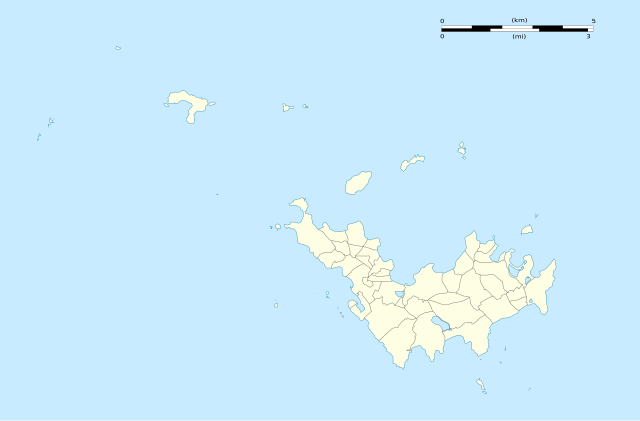
English: Blank administrative map of the overseas collectivity of Saint Barthélemy, France, with Quartiers boundaries, for geo-location purpose.
Français : Carte administrative vierge de la collectivité d'outre-mer de Saint-Barthélemy, France, avec limites des quartiers, destinée à la géolocalisation. Estimated scales: 1:200,000 (precision: 50 m)
Geographic limits of the map:
|
||
| Data | |||
| Fonte |
Trabayu propiu
|
||
| Autor | Eric Gaba (Sting - fr:Sting) | ||
| Permisu (Cómo reutilizar esti ficheru) |
|
||
| Otres versiones |
|


Llicencia
Eric Gaba, Wikimedia Commons user Sting, titular de los drechos d'autor d'esta obra, la espubliza baxo les siguientes llicencies:
Esti ficheru ta disponible baxo la llicencia Creative Commons Reconocimientu-Compartir igual 3.0 xenérica.
Reconocimientu: Eric Gaba, Wikimedia Commons user Sting
- Ye llibre:
- pa compartir – pa copiar, distribuir y comunicar públicamente la obra
- pa remezclar – p'adautar la obra
- Baxo les condiciones siguientes:
- reconocimientu – Tienes de dar el créitu apropiáu, apurrir un enllaz a la llicencia ya indicar si realizasti dalgún cambéu. Puedes faelo de cualquier mou razonable ,pero non de manera que suxera l'encontu del autor pa ti o pal usu que faigas.
- compartir igual – Si entemeces, tresformes o te bases nesti material, tienes de distribuir les tos contribuciones baxo la mesma llicencia o una compatible cola orixinal.

|
Autorízase la copia, distribución y/o cambéu d'esti documentu baxo los términos de la Llicencia de documentación llibre GNU, versión 1.2 o cualesquier otra que nel futuru espublice la Free Software Foundation; ensin seiciones invariables, testos de portada, nin testos de contraportada. S'inclúi una copia de la llicencia na seición titulada GNU Free Documentation License. |
Pues seleicionar la llicencia que prefieras.
Historial del ficheru
Calca nuna fecha/hora pa ver el ficheru como taba daquella.
| Data/Hora | Miniatura | Dimensiones | Usuariu | Comentariu | |
|---|---|---|---|---|---|
| actual | 02:01 26 feb 2010 | | 1175 × 772 (135 kB) | Sting | == {{int:filedesc}} == {{Location|17|55|30|N|62|51|45|W|scale:50000}} <br/> {{Information |Description={{en|Blank administrative map of the overseas collectivity of Saint Barthélemy, [[:en:France|Fr |
Usu del ficheru
Les páxines siguientes usen esti ficheru:
Usu global del ficheru
Estes otres wikis usen esti ficheru:
- Usu en ar.wikipedia.org
- Usu en bg.wikipedia.org
- Usu en bn.wikipedia.org
- Usu en bs.wikipedia.org
- Usu en ceb.wikipedia.org
- Plantilya:Location map Saint Barthélemy
- West Channel
- South Channel
- Goat Island
- Sugarloaf
- Southeast Channel
- Canal du Sud
- Baie de Saint-Jean
- Saint Barthelemy
- Saint Bartholomew Island
- Saint-Barthélemy (pagklaro)
- Roches Rouges
- Roques (pagklaro)
- Île de la Pointe
- Le Pain de Sucre
- Canal de l'Ouest
- Pointe Nègre
- Pointe Negre
- Pointe Lézarde
- Les Saintes
- Les Islettes (pagklaro)
- Les Baleines
- Le Carénage
- La Tortue
- Île Tortue
- La Baleine (pagklaro)
- Roche Baleine
- Gustaf
- Grande Pointe
- Île Frégate
- Ile Fregate
- Îlet Frégate
- Fourche
- Pointe Colombier
- Ile Coco
- Barrel of Beef
- Le Boeuf
- Baie des Flamands
- Morne du Vitet
- Pointe à Toigny
- Île Toc Vers
- Roche Table
- Canal du Sud-Est
- Canal du Sud (agianan)
- Baie de Saint-Jean (luuk sa San Bartolomeyo)
- Île Saint-Barthélemy
Ver más usos globales d'esti ficheru.