
Ficheru:Sahara dust plume Nov 1998.jpg

Tamañu d'esta previsualización: 800 × 567 pixels. Otres resoluciones: 320 × 227 pixels | 640 × 454 pixels | 1024 × 726 pixels | 1280 × 908 pixels | 2560 × 1816 pixels | 4449 × 3156 pixels.
Ficheru orixinal (4449 × 3156 píxels, tamañu de ficheru: 5,06 MB, triba MIME: image/jpeg)
Resume
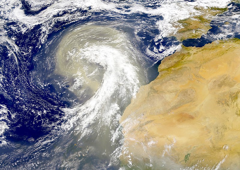
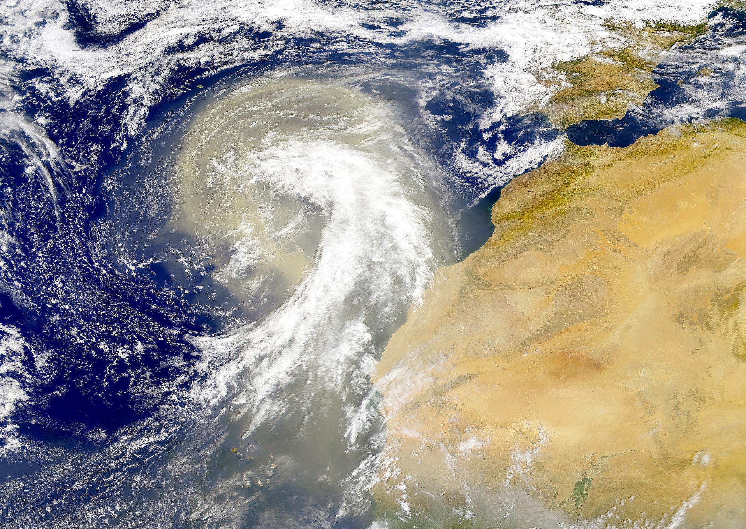
| Descripción | Dust plume off the Sahara desert over the northeast Atlantic Ocean. The Azores are visible at the northwest edge of the dust plume in this SeaWiFS image. The Cape Verde Islands can be seen through the dust near the bottom of the image. Sensor: OrbView-2/SeaWiFS |
| Data | |
| Fonte | NASA Visible Earth |
| Autor | Provided by the SeaWiFS Project, NASA/Goddard Space Flight Center, and ORBIMAGE |
Llicencia
| This image is from the Sea-viewing Wide Field-of-view Sensor (SeaWiFS) Project and more than 5 years old.
Satellite data captured by the SeaWIFS sensor are released into the public domain 5 years after capture. Data less than five years old can be re-used only for educational or scientific purposes; any commercial use of such images must be coordinated with GeoEye. [1] |
| This work has been released into the public domain by its copyright holder, GeoEye. This applies worldwide. En dellos países seique esto nun seya posible llegalmente; nesti casu: GeoEye da a cualesquier persona permisu pa usar esta obra pa cualesquier propósitu, ensin denguna condición, menos si eses condiciones requierense pola llei.
|
Historial del ficheru
Calca nuna fecha/hora pa ver el ficheru como taba daquella.
| Data/Hora | Miniatura | Dimensiones | Usuariu | Comentariu | |
|---|---|---|---|---|---|
| actual | 00:01 6 pay 2005 | | 4449 × 3156 (5,06 MB) | Tintazul | {{Information| |Description=Dust plume off the Sahara desert over the northeast Atlantic Ocean. The Azores are visible at the northwest edge of the dust plume in this SeaWiFS image. The Cape Verde Islands can be seen through the dust near the bottom of th |
Usu del ficheru
La páxina siguiente usa esti ficheru:
Usu global del ficheru
Estes otres wikis usen esti ficheru:
- Usu en ar.wikipedia.org
- Usu en azb.wikipedia.org
- Usu en ca.wikipedia.org
- Usu en en.wikipedia.org
- Usu en en.wikivoyage.org
- Usu en eo.wikipedia.org
- Usu en es.wikipedia.org
- Usu en fa.wikipedia.org
- Usu en ga.wikipedia.org
- Usu en hu.wikipedia.org
- Usu en ko.wikipedia.org
- Usu en lt.wikipedia.org
- Usu en lv.wikipedia.org
- Usu en ml.wikipedia.org
- Usu en uk.wikipedia.org
- Usu en vi.wikipedia.org
- Usu en www.wikidata.org