
Ficheru:OttomanEmpire1801.jpg
Ficheru orixinal (1638 × 1296 píxels, tamañu de ficheru: 605 kB, triba MIME: image/jpeg)

Resume
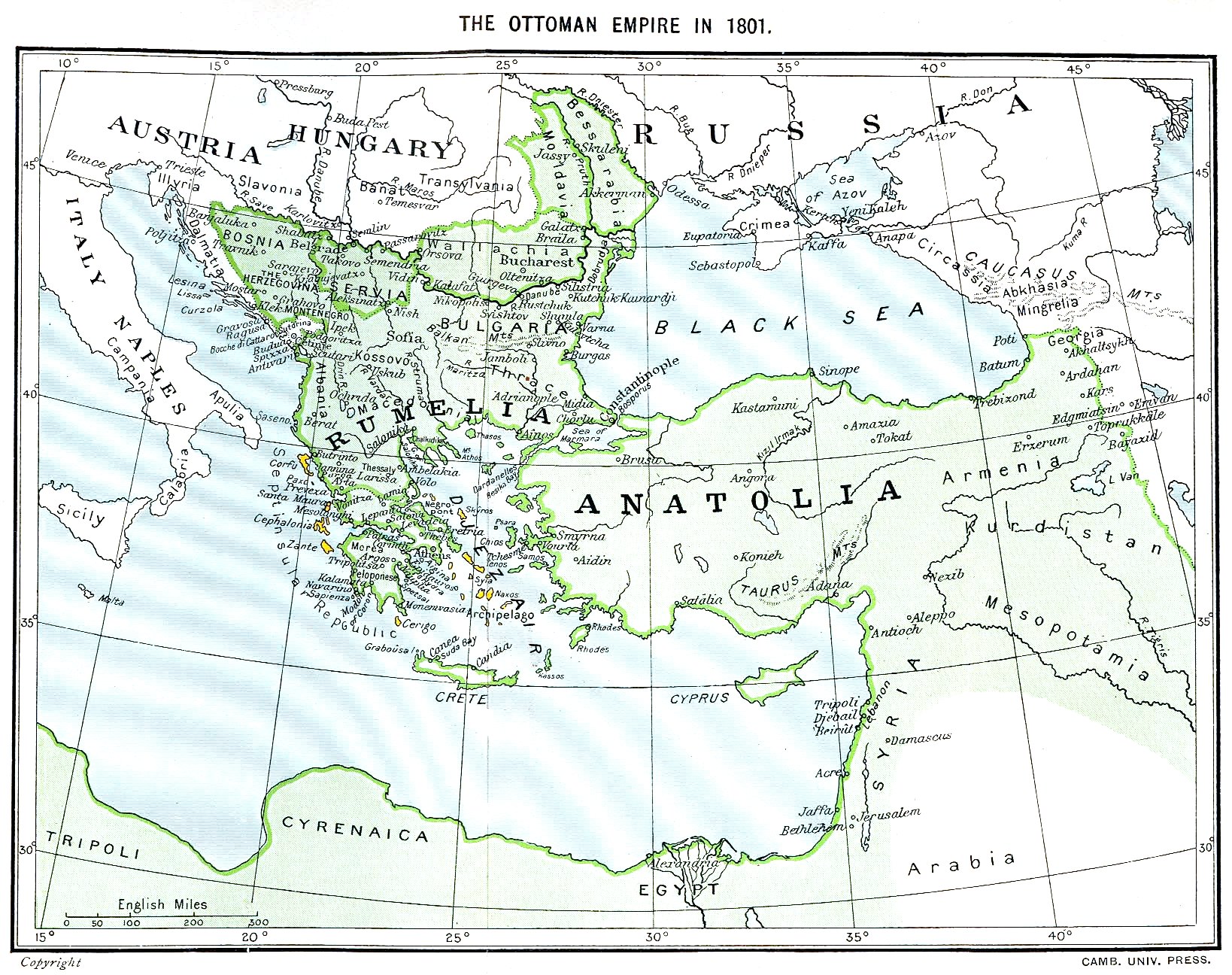
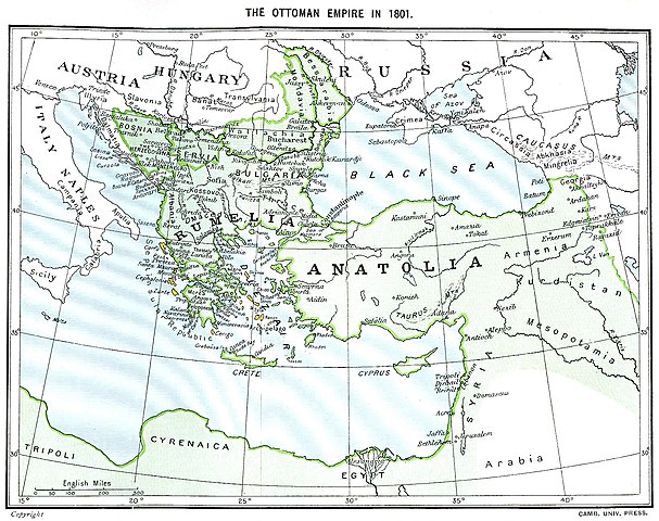
Ottoman Empire (green) and Septinsular Republic (yellow) in 1801.
Llicencia
|
Este material está en dominio público en los demás países donde el derecho de autor se extiende por 70 años (o menos) tras la muerte del autor.
| |
| Esta obra ha sido identificada como libre de las restricciones conocidas en virtud del derecho de autor, incluyendo todos los derechos conexos. | |
Historial del ficheru
Calca nuna fecha/hora pa ver el ficheru como taba daquella.
| Data/Hora | Miniatura | Dimensiones | Usuariu | Comentariu | |
|---|---|---|---|---|---|
| actual | 16:06 11 xin 2023 | | 1638 × 1296 (605 kB) | Enyavar | Reverted to version as of 08:56, 11 March 2006 (UTC) --> even if they are wrong, don't change historical maps! |
| 17:48 3 feb 2014 |  | 1638 × 1296 (518 kB) | Spiridon Ion Cepleanu | Some little changes according with the 1801 situation : The Septinsular Rep. includes Ionian Is., not the Cyclades, Serbia became autonomous 1817... | |
| 08:56 11 mar 2006 |  | 1638 × 1296 (605 kB) | Julo | Ottoman Empire (green) & Septinsular Republic (yellow) in 1801, on the 19th century map {{PD-old}} category:19th century mapsCategory:Historical maps of the Middle EastCategory:Historical maps of the Balkans[[Category:Historical maps of Africa |
Usu del ficheru
Nun hai páxines qu'usen esti ficheru.
Usu global del ficheru
Estes otres wikis usen esti ficheru:
- Usu en azb.wikipedia.org
- Usu en ba.wikipedia.org
- Usu en el.wikipedia.org
- Usu en fr.wikipedia.org
- Usu en hy.wikipedia.org
- Usu en la.wikipedia.org
- Usu en pl.wikipedia.org
- Usu en sq.wikipedia.org
- Usu en sv.wikipedia.org
- Usu en uk.wikipedia.org