
Ficheru:North Sea relief location map.jpg

Tamañu d'esta previsualización: 511 × 599 pixels. Otres resoluciones: 205 × 240 pixels | 409 × 480 pixels | 988 × 1159 pixels.
Ficheru orixinal (988 × 1159 píxels, tamañu de ficheru: 909 kB, triba MIME: image/jpeg)
| Descripción |
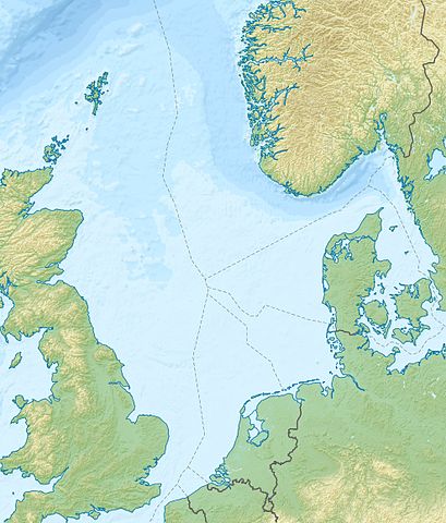
Deutsch: Positionskarte der Nordsee Quadratische Plattkarte, N-S-Streckung 180 %. Geographische Begrenzung der Karte: * N: 62.5° N * S: 50.5° N * W: 5.2° W * O: 13.2° O English: Location map of the North Sea Equirectangular projection, N/S stretching 180 %. Geographic limits of the map: * N: 62.5° N * S: 50.5° N * W: 5.2° W * E: 13.2° E |
| Data | (UTC) |
| Fonte | |
| Autor |
|
| Otres versiones |
Derivative works of this file: Action of 28 January 1945 map.jpg
|

| Esta ye una imaxe retocada, lo que significa que foi modificada dixitalmente de la so versión orixinal. La orixinal pue vese equí: North Sea location map.svg:
|
Yo, el titular de los drechos d'autor d'esta obra, la espublizo baxo la siguiente llicencia:
Esti ficheru ta disponible baxo la llicencia Creative Commons Reconocimientu-Compartir igual 3.0 xenérica.
- Ye llibre:
- pa compartir – pa copiar, distribuir y comunicar públicamente la obra
- pa remezclar – p'adautar la obra
- Baxo les condiciones siguientes:
- reconocimientu – Tienes de dar el créitu apropiáu, apurrir un enllaz a la llicencia ya indicar si realizasti dalgún cambéu. Puedes faelo de cualquier mou razonable ,pero non de manera que suxera l'encontu del autor pa ti o pal usu que faigas.
- compartir igual – Si entemeces, tresformes o te bases nesti material, tienes de distribuir les tos contribuciones baxo la mesma llicencia o una compatible cola orixinal.
Rexistru de xubíes orixinal
This image is a derivative work of the following images:
- File:North_Sea_location_map.svg licensed with Cc-by-sa-3.0
- 2010-06-18T08:49:38Z NordNordWest 988x1159 (596438 Bytes) == {{int:filedesc}} == {{Information |Description= {{de|Positionskarte der [[:de:Nordsee|Nordsee]]}} Quadratische Plattkarte, N-S-Streckung 180 %. Geographische Begrenzung der Karte: * N: 62.5° N * S: 50.5° N * W: 5.2° W *
Uploaded with derivativeFX
Historial del ficheru
Calca nuna fecha/hora pa ver el ficheru como taba daquella.
| Data/Hora | Miniatura | Dimensiones | Usuariu | Comentariu | |
|---|---|---|---|---|---|
| actual | 19:11 18 xun 2010 | | 988 × 1159 (909 kB) | Uwe Dedering | {{Information |Description={{de|Positionskarte der Nordsee}} Quadratische Plattkarte, N-S-Streckung 180 %. Geographische Begrenzung der Karte: * N: 62.5° N * S: 50.5° N * W: 5.2° W * O: 13.2° O {{en|Location map of the [[:en:North Sea| |
Usu del ficheru
Les páxines siguientes usen esti ficheru:
Usu global del ficheru
Estes otres wikis usen esti ficheru:
- Usu en ar.wikipedia.org
- Usu en az.wikipedia.org
- Usu en be.wikipedia.org
- Usu en ca.wikipedia.org
- Usu en ceb.wikipedia.org
- Usu en cs.wikipedia.org
- Usu en da.wikipedia.org
- Usu en de.wikipedia.org
- Usu en de.wikivoyage.org
- Usu en en.wikipedia.org
- Battle of Sluys
- Piper Alpha
- Brae oilfield
- Ekofisk oil field
- Statfjord oil field
- Gullfaks oil field
- Oseberg oil field
- Snorre oil field
- Troll gas field
- Heligoland Bight
- Piper oilfield
- Buchan Oil Field
- Battle of Zutphen
- Auk oilfield
- Dunlin oilfield
- Cormorant oilfield
- Eider oilfield
- Fulmar Oil Field
- Siege of Breda (1624)
- Tern oilfield
- Clair oilfield
- Mittelplate
- Valhall oil field
- SS Mount Ida
- Harding oilfield
- Everest gasfield
Ver más usos globales d'esti ficheru.