
Ficheru:Maps-roman-empire-peak-150AD.jpg
Ficheru orixinal (2620 × 2076 píxels, tamañu de ficheru: 1,12 MB, triba MIME: image/jpeg)
Resume
| Descripción |
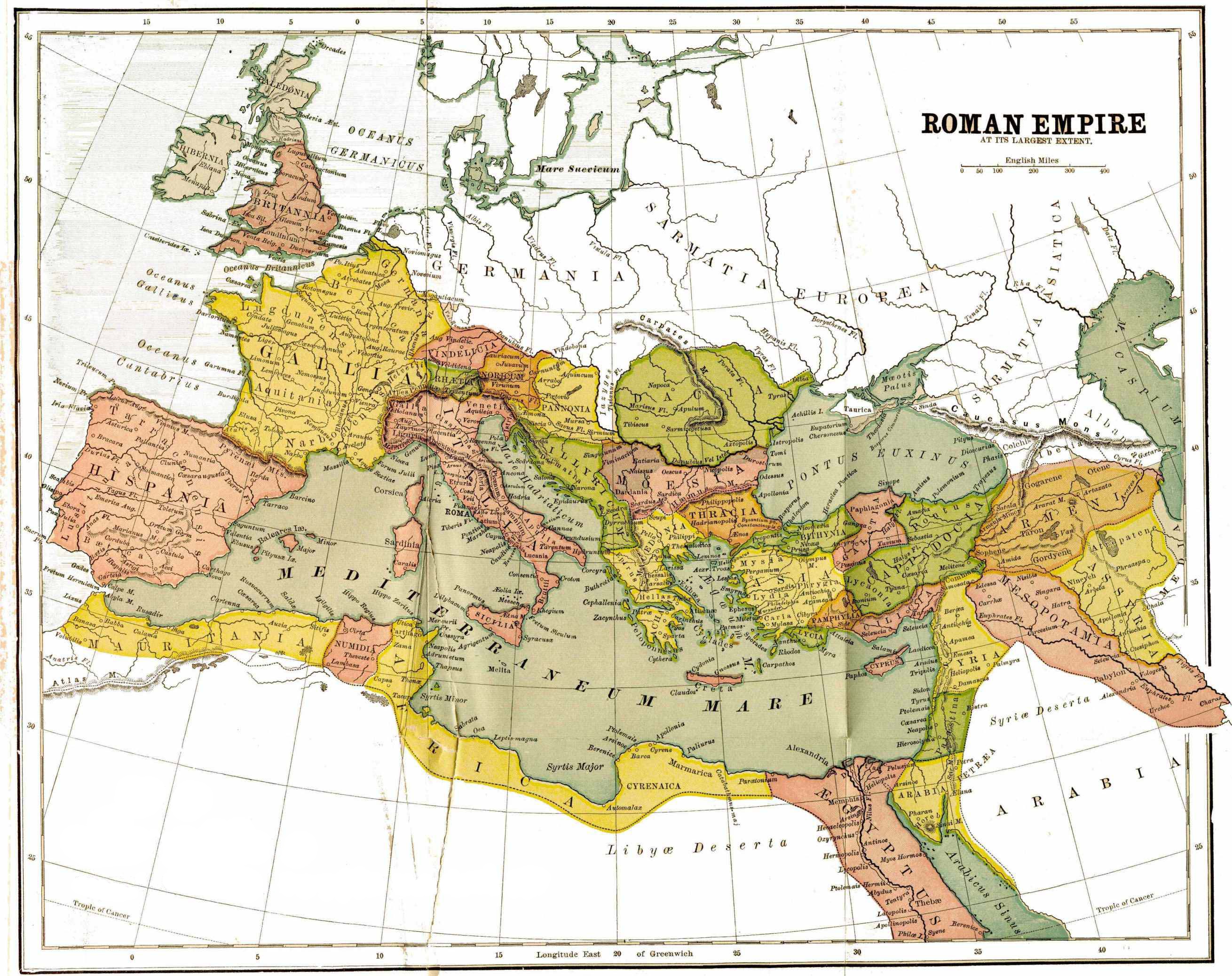
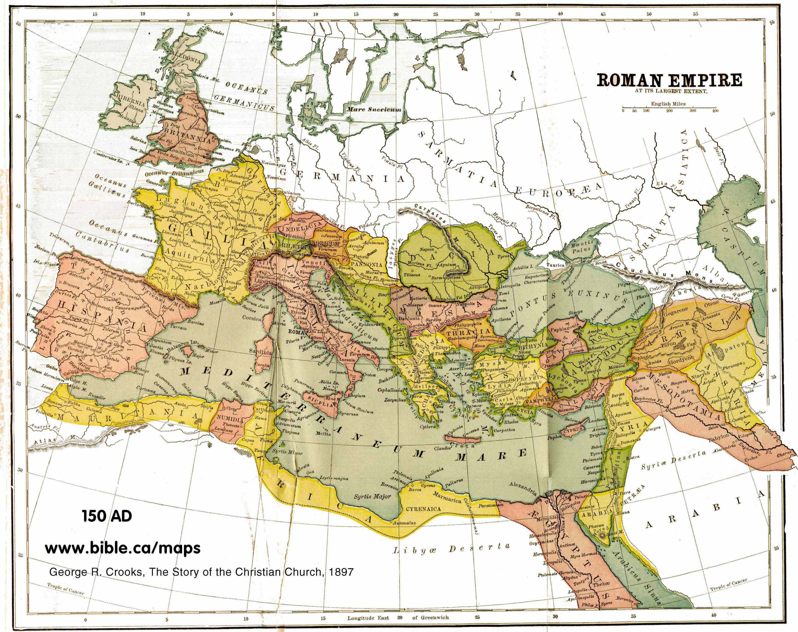
English: map of the Roman Empire, with provinces, in 150 AD |
| Data | |
| Fonte | http://www.bible.ca/maps/maps-roman-empire-peak-150AD.jpg |
| Autor | George R. Crooks |
Llicencia
|
Este material está en dominio público en los demás países donde el derecho de autor se extiende por 70 años (o menos) tras la muerte del autor.
| |
| Esta obra ha sido identificada como libre de las restricciones conocidas en virtud del derecho de autor, incluyendo todos los derechos conexos. | |
Historial del ficheru
Calca nuna fecha/hora pa ver el ficheru como taba daquella.
| Data/Hora | Miniatura | Dimensiones | Usuariu | Comentariu | |
|---|---|---|---|---|---|
| actual | 19:50 12 feb 2012 | | 2620 × 2076 (1,12 MB) | Quibik | Removed the watermark. |
| 19:35 21 ago 2010 |  | 2620 × 2076 (823 kB) | Ratzer | {{Information |Description={{en|1=map of the Roman Empire, with provinces, in 150 AD}} |Source=http://www.bible.ca/maps/maps-roman-empire-peak-150AD.jpg |Author=George R. Crooks |Date=1897 |Permission= |other_versions= }} [[Category:Maps of the Roman Emp |
Usu del ficheru
La páxina siguiente usa esti ficheru:
Usu global del ficheru
Estes otres wikis usen esti ficheru:
- Usu en af.wikipedia.org
- Usu en ba.wikipedia.org
- Usu en en.wikipedia.org
- Usu en hu.wikipedia.org
- Usu en incubator.wikimedia.org
- Usu en it.wikipedia.org
- Usu en lez.wikipedia.org
- Usu en nl.wikipedia.org
- Usu en pt.wikipedia.org
- Usu en ru.wikipedia.org