
Ficheru:Leinster locator map.svg

Tamañu de la vista previa PNG d'esti ficheru SVG: 481 × 599 pixels. Otres resoluciones: 192 × 240 pixels | 385 × 480 pixels | 616 × 768 pixels | 822 × 1024 pixels | 1643 × 2048 pixels | 1450 × 1807 pixels.
Ficheru orixinal (ficheru SVG, 1450 × 1807 píxels nominales, tamañu de ficheru: 686 kB)
Resume
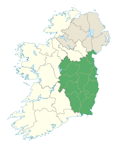
| Descripción | Locator map of Leinster. |
| Data | (UTC) |
| Fonte | |
| Autor |
|
Llicencia
Yo, el titular de los drechos d'autor d'esta obra, la espublizo baxo la siguiente llicencia:
Esti ficheru ta disponible baxo la llicencia Creative Commons Reconocimientu-Compartir igual 3.0 xenérica.
- Ye llibre:
- pa compartir – pa copiar, distribuir y comunicar públicamente la obra
- pa remezclar – p'adautar la obra
- Baxo les condiciones siguientes:
- reconocimientu – Tienes de dar el créitu apropiáu, apurrir un enllaz a la llicencia ya indicar si realizasti dalgún cambéu. Puedes faelo de cualquier mou razonable ,pero non de manera que suxera l'encontu del autor pa ti o pal usu que faigas.
- compartir igual – Si entemeces, tresformes o te bases nesti material, tienes de distribuir les tos contribuciones baxo la mesma llicencia o una compatible cola orixinal.
Historial del ficheru
Calca nuna fecha/hora pa ver el ficheru como taba daquella.
| Data/Hora | Miniatura | Dimensiones | Usuariu | Comentariu | |
|---|---|---|---|---|---|
| actual | 19:48 7 xin 2012 | | 1450 × 1807 (686 kB) | NikNaks | Removing modern boundaries |
| 18:10 7 xin 2012 |  | 1450 × 1807 (707 kB) | NikNaks | More detailed map | |
| 17:52 7 xin 2012 |  | 400 × 500 (281 kB) | NikNaks93 | == {{int:filedesc}} == {{Information |Description=Locator map of Leinster. |Source=*File:Ireland_trad_counties_named.svg |Date=2012-01-07 17:50 (UTC) |Author=*File:Ireland_trad_counties_named.svg: *[[:File:Population_density_of_Ireland_map2002 |
Usu del ficheru
La páxina siguiente usa esti ficheru:
Usu global del ficheru
Estes otres wikis usen esti ficheru:
- Usu en ar.wikipedia.org
- Usu en az.wikipedia.org
- Usu en be.wikipedia.org
- Usu en bg.wikipedia.org
- Usu en ca.wikipedia.org
- Usu en ceb.wikipedia.org
- Usu en cs.wikipedia.org
- Usu en da.wikipedia.org
- Usu en el.wikipedia.org
- Usu en en.wikipedia.org
- Leinster
- Hill of Tara
- List of Ireland-related topics
- Turlough Hill
- Wicklow Mountains
- Lists of mountains in Ireland
- Bray Head
- Faughan Hill
- Lugnaquilla
- Slieve Bloom Mountains
- Kilmashogue
- Slieve Foy
- Glenmalure
- Carn Clonhugh
- Three Rock Mountain
- Kippure
- Ben of Howth
- Shielmartin Hill
- Hill of Uisneach
- Larch Hill
- Mount Leinster
- Clermont Carn
- Dalkey Hill
- Great Sugar Loaf
- Luggala
- Hill of Ben
- Knockeyon
- Djouce
- Mullaghcleevaun
- Tonelagee
- Camaderry
- Little Sugar Loaf
- Sugarloaf (West Wicklow)
- Church Mountain
- Tibradden Mountain
- Hill of Ward
- Mullaghmeen
- Croghan Hill
Ver más usos globales d'esti ficheru.