
Ficheru:Isles of Scilly UK location map.svg

Tamañu de la vista previa PNG d'esti ficheru SVG: 677 × 600 pixels. Otres resoluciones: 271 × 240 pixels | 542 × 480 pixels | 867 × 768 pixels | 1156 × 1024 pixels | 2312 × 2048 pixels | 1340 × 1187 pixels.
Ficheru orixinal (ficheru SVG, 1340 × 1187 píxels nominales, tamañu de ficheru: 558 kB)
| Descripción |
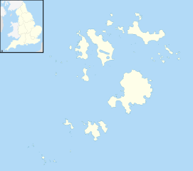
Blank map of the Isles of Scilly, UK with districts shown. Equirectangular map projection on WGS 84 datum, with N/S stretched 150% Geographic limits:
|
| Data | |
| Fonte | Ordnance Survey OpenData. Most data from Boundary-Line product. Lake data from Meridian 2 product. Inset derived from England location map.svg by Spischot. |
| Autor | Nilfanion, created using Ordnance Survey data |
| Permisu (Cómo reutilizar esti ficheru) |
Esti ficheru ta disponible baxo la llicencia Creative Commons Reconocimientu-Compartir igual 3.0 xenérica. Reconocimientu: Contains Ordnance Survey data © Crown copyright and database right
|
Historial del ficheru
Calca nuna fecha/hora pa ver el ficheru como taba daquella.
| Data/Hora | Miniatura | Dimensiones | Usuariu | Comentariu | |
|---|---|---|---|---|---|
| actual | 20:39 26 set 2010 | | 1340 × 1187 (558 kB) | Nilfanion | {{Information |Description=Blank map of the Isles of Scilly, UK with districts shown. Equirectangular map projection on WGS 84 datum, with N/S stretched 150% Geographic limits: *West: 6.45W *East: 6.23W *North: 49.99N *South: 49.86 |
Usu del ficheru
La páxina siguiente usa esti ficheru:
Usu global del ficheru
Estes otres wikis usen esti ficheru:
- Usu en af.wikipedia.org
- Usu en ar.wikipedia.org
- Usu en arz.wikipedia.org
- Usu en ca.wikipedia.org
- Usu en ceb.wikipedia.org
- Usu en de.wikipedia.org
- Bishop Rock
- Samson (Insel)
- Annet (Scilly-Inseln)
- St Mary’s (Scilly-Inseln)
- St Mary’s Airport
- Tresco
- Hugh Town
- St. Martin’s
- Great Ganilly
- Teän
- St. Helen’s
- Zantman’s Rock
- Crim Rocks
- Round Island (Scilly-Inseln)
- Rosevear
- Bryher
- Gweal
- Gugh
- Vorlage:Positionskarte England Scilly-Inseln
- St. Agnes (Scilly-Inseln)
- White Island (Scilly-Inseln)
- Norrard Rocks
- Western Rocks (Scilly-Inseln)
- Eastern Isles
- Tresco Heliport
- Usu en el.wikipedia.org
- Usu en en.wikipedia.org
- Samson, Isles of Scilly
- Tresco, Isles of Scilly
- St Mary's, Isles of Scilly
- Hugh Town
- HMS Colossus (1787)
- Bant's Carn
- Porth Hellick Down
- Pednathise Head
- St Agnes, Isles of Scilly
- Bryher
- St Martin's, Isles of Scilly
- Zantman's Rock
- MV Cita
- Minnehaha (cargo ship)
- SS Thames
- Annet, Isles of Scilly
- Crim Rocks
- Gugh
Ver más usos globales d'esti ficheru.