
Ficheru:Island of Ireland location map Tyrone.svg

Tamañu de la vista previa PNG d'esti ficheru SVG: 796 × 599 pixels. Otres resoluciones: 319 × 240 pixels | 638 × 480 pixels | 1020 × 768 pixels | 1280 × 964 pixels | 2560 × 1928 pixels | 931 × 701 pixels.
Ficheru orixinal (ficheru SVG, 931 × 701 píxels nominales, tamañu de ficheru: 826 kB)
| Descripción |
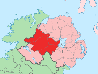
English: The island of Ireland, showing international border between Northern Ireland and Republic of Ireland, traditional provinces, traditional counties, and local authority areas in the Republic of Ireland and Northern Ireland. |
||
| Data | (UTC) | ||
| Fonte | Island of Ireland location map.svg | ||
| Autor | |||
| SVG desarrollo | El código fuente de esta imagen SVG es válido. Este mapa fue creado con Adobe Illustrator
|
Yo, el titular de los drechos d'autor d'esta obra, la espublizo baxo la siguiente llicencia:
Esti ficheru ta disponible baxo la llicencia Creative Commons Reconocimientu-Compartir igual 3.0 xenérica.
- Ye llibre:
- pa compartir – pa copiar, distribuir y comunicar públicamente la obra
- pa remezclar – p'adautar la obra
- Baxo les condiciones siguientes:
- reconocimientu – Tienes de dar el créitu apropiáu, apurrir un enllaz a la llicencia ya indicar si realizasti dalgún cambéu. Puedes faelo de cualquier mou razonable ,pero non de manera que suxera l'encontu del autor pa ti o pal usu que faigas.
- compartir igual – Si entemeces, tresformes o te bases nesti material, tienes de distribuir les tos contribuciones baxo la mesma llicencia o una compatible cola orixinal.
Rexistru de xubíes orixinal
This image is a derivative work of the following images:
- Island of Ireland location map.svg licensed with Cc-by-sa-3.0
- 2010-03-06T20:43:33Z Rannpháirtí anaithnid 1450x1807 (679207 Bytes) Fix incorrectly coloured isands.
- 2010-03-03T22:19:29Z Rannpháirtí anaithnid 1450x1807 (679744 Bytes) {{Information |Description={{de|Positionskarte von [[:de:Irland|Irland]]}} Quadratische Plattkarte, N-S-Streckung 170 %. Geographische Begrenzung der Karte: * N: 55.6° N * S: 51.2° N * W: 11.0° W * O: 5.0° W {{en|Location
Uploaded with derivativeFX
Historial del ficheru
Calca nuna fecha/hora pa ver el ficheru como taba daquella.
| Data/Hora | Miniatura | Dimensiones | Usuariu | Comentariu | |
|---|---|---|---|---|---|
| actual | 12:53 19 xnt 2010 | | 931 × 701 (826 kB) | Mabuska | another attempt |
| 12:41 19 xnt 2010 |  | 931 × 701 (819 kB) | Mabuska | fixed boundaries | |
| 11:20 19 xnt 2010 |  | 934 × 712 (827 kB) | Mabuska | {{Information |Description={{en|The island of Ireland, showing international border between Northern Ireland and Republic of Ireland, traditional provinces, traditional counties, and local authority areas in the Republic of Ireland and Northern Ireland.}} |
Usu del ficheru
La páxina siguiente usa esti ficheru:
Usu global del ficheru
Estes otres wikis usen esti ficheru:
- Usu en an.wikipedia.org
- Usu en ar.wikipedia.org
- Usu en bg.wikipedia.org
- Usu en ca.wikipedia.org
- Usu en cs.wikipedia.org
- Usu en de.wikipedia.org
- Usu en en.wikipedia.org
- Usu en es.wikipedia.org
- Usu en eu.wikipedia.org
- Omagh
- Lankide:Euskaldunaa
- Dungannon
- Cookstown
- Strabane
- Tyrone konderria
- Txantiloi:Tyrone konderriko udalerriak
- Coagh
- Coalisland
- Altamuskin
- Altishane
- Altmore
- Ardboe
- Ardstraw
- Artigarvan
- Augher
- Aughnacloy (Tyrone konderria)
- Ballygawley (Tyrone konderria)
- Ballymagorry
- Ballymully Glebe
- Benburb
- Beragh
- Brackaville
- Bready
- Brockagh
- Caledon (Tyrone konderria)
- Cappagh (Tyrone konderria)
- Carnteel
- Carrickmore
- Castlecaulfield
- Castlederg
- Clady (Tyrone konderria)
- Clanabogan
- Clogher
- Cranagh
- Creggan (Tyrone konderria)
- Derrycrin
- Derryloughan (Tyrone konderria)
- Derrytresk
Ver más usos globales d'esti ficheru.