
Ficheru:India physical map-es.svg

Tamañu de la vista previa PNG d'esti ficheru SVG: 530 × 599 pixels. Otres resoluciones: 212 × 240 pixels | 425 × 480 pixels | 680 × 768 pixels | 906 × 1024 pixels | 1812 × 2048 pixels | 1639 × 1852 pixels.
Ficheru orixinal (ficheru SVG, 1639 × 1852 píxels nominales, tamañu de ficheru: 992 kB)
Resume
| Descripción |
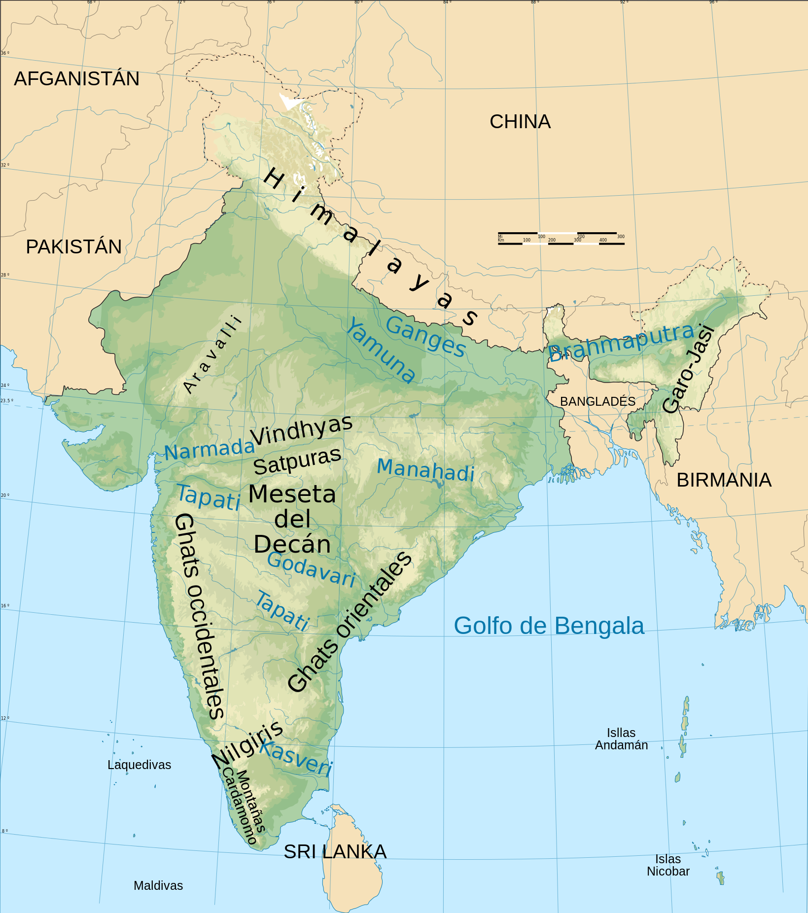
English: India physical map |
| Data | |
| Fonte | India physical map.svg |
| Autor |
|
Llicencia
Yo, el titular de los drechos d'autor d'esta obra, la espublizo baxo la siguiente llicencia:
Este archivo está disponible bajo la licencia Creative Commons Attribution-Share Alike 4.0 International.
- Ye llibre:
- pa compartir – pa copiar, distribuir y comunicar públicamente la obra
- pa remezclar – p'adautar la obra
- Baxo les condiciones siguientes:
- reconocimientu – Tienes de dar el créitu apropiáu, apurrir un enllaz a la llicencia ya indicar si realizasti dalgún cambéu. Puedes faelo de cualquier mou razonable ,pero non de manera que suxera l'encontu del autor pa ti o pal usu que faigas.
- compartir igual – Si entemeces, tresformes o te bases nesti material, tienes de distribuir les tos contribuciones baxo la mesma llicencia o una compatible cola orixinal.
Historial del ficheru
Calca nuna fecha/hora pa ver el ficheru como taba daquella.
| Data/Hora | Miniatura | Dimensiones | Usuariu | Comentariu | |
|---|---|---|---|---|---|
| actual | 22:11 11 avi 2015 | | 1639 × 1852 (992 kB) | Rowanwindwhistler | Larger still |
| 22:00 11 avi 2015 |  | 1639 × 1852 (991 kB) | Rowanwindwhistler | Larger fonts, colours from https://en.wikipedia.org/wiki/Wikipedia:WikiProject_Maps/Conventions#Topographic_maps | |
| 07:52 11 avi 2015 |  | 1639 × 1852 (969 kB) | Rowanwindwhistler | Font workaround | |
| 07:49 11 avi 2015 |  | 1639 × 1852 (969 kB) | Rowanwindwhistler | User created page with UploadWizard |
Usu del ficheru
La páxina siguiente usa esti ficheru:
Usu global del ficheru
Estes otres wikis usen esti ficheru:
- Usu en es.wikipedia.org