
Ficheru:Gales Bay.jpg
Tamañu d'esta previsualización: 800 × 536 pixels. Otres resoluciones: 320 × 214 pixels | 640 × 429 pixels | 1024 × 686 pixels | 1280 × 857 pixels.
Ficheru orixinal (1280 × 857 píxels, tamañu de ficheru: 146 kB, triba MIME: image/jpeg)
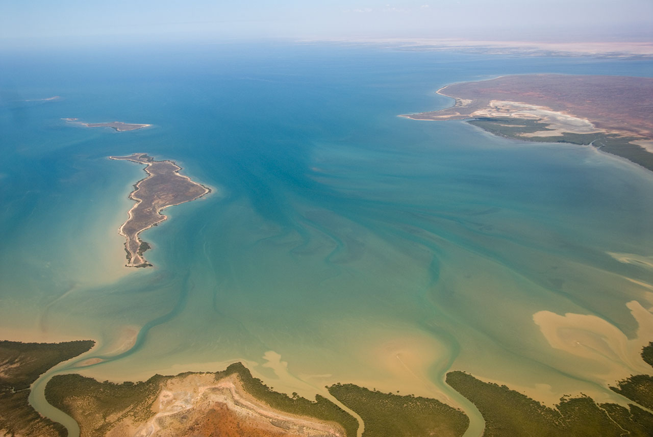
| Descripción | This is an aerial photograph of Gales Bay, a bay at the south end of Exmouth Gulf, Western Australia. The nearest foreground is Doole Island; behind it is Roberts Island; the further island is possibly Whitmore Island. The land on the right is the Sandalwood Peninsula. In the top right hand corner some of Giralia Bay can just be seen; across the top can be seen the continuing coastline of Western Australia. |
| Data | |
| Fonte | https://www.flickr.com/photos/61952179@N00/366312114/ |
| Autor | Jon Hanson |
| Permisu (Cómo reutilizar esti ficheru) |
Este archivo se encuentra bajo la licencia Creative Commons Genérica de Atribución/Compartir-Igual 2.0.
|
| Posición de la cámara | | Ubicación de esta y otras imágenes en: OpenStreetMap |
|---|
| This image, originally posted to Flickr, was reviewed on 18 May 2008 by the administrator or reviewer Kanonkas, who confirmed that it was available on Flickr under the stated license on that date. |
Historial del ficheru
Calca nuna fecha/hora pa ver el ficheru como taba daquella.
| Data/Hora | Miniatura | Dimensiones | Usuariu | Comentariu | |
|---|---|---|---|---|---|
| actual | 12:20 18 may 2008 | | 1280 × 857 (146 kB) | Hesperian | {{Information |Description=This is an aerial photograph of Gales Bay, a bay at the south end of Exmouth Gulf, Western Australia. The island in the foreground is Doole Island; behind it is Roberts Island; the further island is ''possibl |
Usu del ficheru
Nun hai páxines qu'usen esti ficheru.
Usu global del ficheru
Estes otres wikis usen esti ficheru:
- Usu en ar.wikipedia.org
- Usu en arz.wikipedia.org
- Usu en ceb.wikipedia.org
- Usu en de.wikipedia.org
- Usu en en.wikipedia.org
- Usu en fi.wiktionary.org
- Usu en lt.wikipedia.org
- Usu en nl.wikipedia.org
- Usu en pnb.wikipedia.org
- Usu en ur.wikipedia.org
- Usu en www.wikidata.org