
Ficheru:FukuokaMapCurrent.png
Tamañu d'esta previsualización: 719 × 599 pixels. Otres resoluciones: 288 × 240 pixels | 576 × 480 pixels | 922 × 768 pixels | 1081 × 901 pixels.
Ficheru orixinal (1081 × 901 píxels, tamañu de ficheru: 42 kB, triba MIME: image/png)
Resume
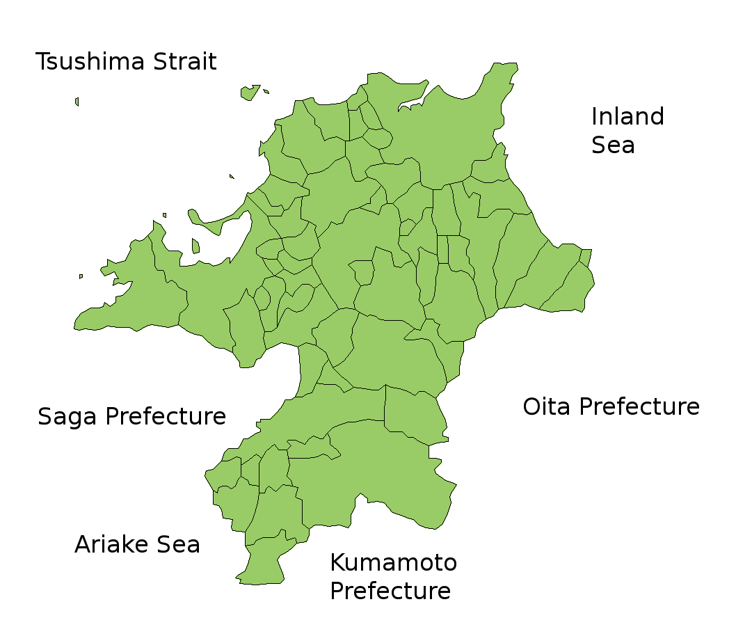
Map of Fukuoka Prefecture, Japan.
Thanks to Aoki Shigenobu and [1]. Colors from Image:TokyoMapCurrent.png by User:Fg2.
Llicencia

|
Esta imaxen tien drechos d'autor. El dueñu de los drechos autoriza'l so usu ensin restriciones, incluyendo toa mena de redistribución, modificaciones y usu comercial. |
Historial del ficheru
Calca nuna fecha/hora pa ver el ficheru como taba daquella.
| Data/Hora | Miniatura | Dimensiones | Usuariu | Comentariu | |
|---|---|---|---|---|---|
| actual | 13:51 5 feb 2010 | | 1081 × 901 (42 kB) | Alberth2 | Kurogi Town, Tachibana Town, Hoshino Village, and Yabe Village were merged into Yame City. |
| 08:10 16 xin 2010 |  | 1081 × 901 (42 kB) | Alberth2 | Maebaru city, Shima town and Nijo town were merged to Itoshima City. | |
| 03:13 12 may 2009 |  | 1081 × 901 (42 kB) | Alberth2 | New map | |
| 23:56 23 xnt 2006 |  | 1081 × 901 (41 kB) | Akanemoto~commonswiki | ||
| 15:46 22 xnt 2006 |  | 1081 × 801 (40 kB) | Akanemoto~commonswiki | ||
| 01:59 22 xnt 2006 |  | 1081 × 801 (40 kB) | Akanemoto~commonswiki | ||
| 21:19 21 xnt 2006 |  | 1081 × 801 (41 kB) | Akanemoto~commonswiki | Map of Fukuoka Prefecture, Japan. Thanks to Aoki Shigenobu and [http://aoki2.si.gunma-u.ac.jp/map/map.html]. Colors from Image:TokyoMapCurrent.png by User:Fg2. Category:Maps of Fukuoka prefecture Category:Maps in English |
Usu del ficheru
Nun hai páxines qu'usen esti ficheru.
Usu global del ficheru
Estes otres wikis usen esti ficheru:
- Usu en az.wikipedia.org
- Usu en ckb.wikipedia.org
- Usu en cs.wikipedia.org
- Usu en eu.wikipedia.org
- Usu en fa.wikipedia.org
- Usu en incubator.wikimedia.org
- Usu en lt.wikipedia.org
- Usu en ms.wikipedia.org
- Usu en no.wikipedia.org
- Usu en pam.wikipedia.org
- Usu en pt.wikipedia.org
- Usu en ru.wikipedia.org
- Usu en sah.wikipedia.org
- Usu en sco.wikipedia.org
- Usu en su.wikipedia.org