
Ficheru:Faroe Islands location map.svg

Tamañu de la vista previa PNG d'esti ficheru SVG: 465 × 600 pixels. Otres resoluciones: 186 × 240 pixels | 372 × 480 pixels | 595 × 768 pixels | 793 × 1024 pixels | 1587 × 2048 pixels | 775 × 1000 pixels.
Ficheru orixinal (ficheru SVG, 775 × 1000 píxels nominales, tamañu de ficheru: 63 kB)
Resume
| Descripción |
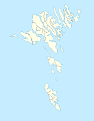
English: Location map of the Faroe Islands
Equirectangular projection, N/S stretching 213 %. Geographic limits of the map:
Deutsch: Positionskarte der Färöer
Quadratische Plattkarte, N-S-Streckung 213 %. Geographische Begrenzung der Karte:
|
| Data | |
| Fonte | Trabayu propiu |
| Autor | Erik Frohne |
| Otres versiones |
Obras derivadas de ésta: Strandfaraskip route map.svg Municipalities of the faroe islands 2005.png |
| SVG desarrollo |
Llicencia
Yo, el titular de los drechos d'autor d'esta obra, la espublizo baxo les siguientes llicencies:

|
Autorízase la copia, distribución y/o cambéu d'esti documentu baxo los términos de la Llicencia de documentación llibre GNU, versión 1.2 o cualesquier otra que nel futuru espublice la Free Software Foundation; ensin seiciones invariables, testos de portada, nin testos de contraportada. S'inclúi una copia de la llicencia na seición titulada GNU Free Documentation License. |
Esti ficheru ta disponible baxo la llicencia Creative Commons Reconocimientu-Compartir igual 3.0 xenérica.
- Ye llibre:
- pa compartir – pa copiar, distribuir y comunicar públicamente la obra
- pa remezclar – p'adautar la obra
- Baxo les condiciones siguientes:
- reconocimientu – Tienes de dar el créitu apropiáu, apurrir un enllaz a la llicencia ya indicar si realizasti dalgún cambéu. Puedes faelo de cualquier mou razonable ,pero non de manera que suxera l'encontu del autor pa ti o pal usu que faigas.
- compartir igual – Si entemeces, tresformes o te bases nesti material, tienes de distribuir les tos contribuciones baxo la mesma llicencia o una compatible cola orixinal.
Pues seleicionar la llicencia que prefieras.
Historial del ficheru
Calca nuna fecha/hora pa ver el ficheru como taba daquella.
| Data/Hora | Miniatura | Dimensiones | Usuariu | Comentariu | |
|---|---|---|---|---|---|
| actual | 13:27 20 avi 2020 | | 775 × 1000 (63 kB) | Hanzlan | Húsar merged with Klaksvík |
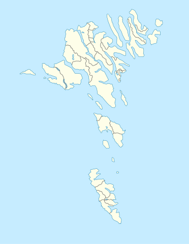
| 12:58 29 abr 2010 |  | 775 × 1000 (77 kB) | Erik Frohne | Removal of some borders according to http://www.us.fo/Default.aspx?ID=5497&M=News&PID=6574&NewsID=1842&CATID=29 | |
| 14:46 7 mar 2009 |  | 775 × 1000 (79 kB) | Erik Frohne | {{Information |Description={{en|1=Location map of the Faroe Islands Equirectangular projection, N/S stretching 213 %. Geographic limits of the map: * N: 62.44° N * S: 61.30° N * W: 7.88° W * E: 6.00° W}} {{de|1=Positionskarte der Färöer Quadra |
Usu del ficheru
Les páxines siguientes usen esti ficheru:
Usu global del ficheru
Estes otres wikis usen esti ficheru:
- Usu en af.wikipedia.org
- Usu en an.wikipedia.org
- Usu en ar.wikipedia.org
- Usu en az.wikipedia.org
- Usu en ba.wikipedia.org
- Usu en be-tarask.wikipedia.org
- Usu en be.wikipedia.org
- Usu en bg.wikipedia.org
Ver más usos globales d'esti ficheru.