
Ficheru:Costa Rica relief location map.jpg

Tamañu d'esta previsualización: 666 × 600 pixels. Otres resoluciones: 267 × 240 pixels | 533 × 480 pixels | 853 × 768 pixels | 1148 × 1034 pixels.
Ficheru orixinal (1148 × 1034 píxels, tamañu de ficheru: 841 kB, triba MIME: image/jpeg)
Resume
| Posición de la cámara | | Ubicación de esta y otras imágenes en: OpenStreetMap |
|---|
| Descripción |
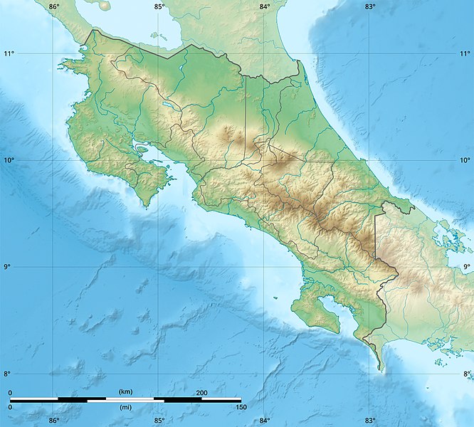
English: Blank relief map of Costa Rica for geo-location purpose.
Note : The Isla del Coco, out of the map, is not shown. Scale : 1:1,856,000 (accuracy : 464 m) Français : Carte du relief vierge du Costa Rica destinée à la géolocalisation.
Note : L´Isla del Coco, hors carte, n'est pas représentée. Échelle : 1:1 856 000 (précision : 464 m) Equirectangular projection centered on 9° 30' N – 84° 15' W, WGS84 datum * West : 86° 30' W * East : 82° W * North : 11° 30' N * South : 7° 30' N |
||
| Data | 2008-06, updated 2022-03 | ||
| Fonte |
Trabayu propiu
|
||
| Autor | Eric Gaba (Sting - fr:Sting) | ||
| Permisu (Cómo reutilizar esti ficheru) |
|
||
| Otres versiones |
|

Llicencia
Eric Gaba (user Sting) for Wikimedia Commons using GEBCO_2021 Grid data, titular de los drechos d'autor d'esta obra, la espubliza baxo les siguientes llicencies:

|
Autorízase la copia, distribución y/o cambéu d'esti documentu baxo los términos de la Llicencia de documentación llibre GNU, versión 1.2 o cualesquier otra que nel futuru espublice la Free Software Foundation; ensin seiciones invariables, testos de portada, nin testos de contraportada. S'inclúi una copia de la llicencia na seición titulada GNU Free Documentation License. |
This file is licensed under the Creative Commons Attribution-Share Alike 4.0 International, 3.0 Unported, 2.5 Generic, 2.0 Generic and 1.0 Generic license.
Reconocimientu: Eric Gaba (user Sting) for Wikimedia Commons using GEBCO_2021 Grid data
- Ye llibre:
- pa compartir – pa copiar, distribuir y comunicar públicamente la obra
- pa remezclar – p'adautar la obra
- Baxo les condiciones siguientes:
- reconocimientu – Tienes de dar el créitu apropiáu, apurrir un enllaz a la llicencia ya indicar si realizasti dalgún cambéu. Puedes faelo de cualquier mou razonable ,pero non de manera que suxera l'encontu del autor pa ti o pal usu que faigas.
- compartir igual – Si entemeces, tresformes o te bases nesti material, tienes de distribuir les tos contribuciones baxo la mesma llicencia o una compatible cola orixinal.
Pues seleicionar la llicencia que prefieras.
Historial del ficheru
Calca nuna fecha/hora pa ver el ficheru como taba daquella.
| Data/Hora | Miniatura | Dimensiones | Usuariu | Comentariu | |
|---|---|---|---|---|---|
| actual | 22:51 30 mar 2022 | | 1148 × 1034 (841 kB) | Sting | New map using new data |
| 01:32 4 pay 2021 |  | 1148 × 1034 (906 kB) | RoboQwezt0x7CB | hand edited to remove non-existing waterbodies, used lower elevation green shade to bucket fill (best I can do without the tools to generate the map) particulary in the south of the country (probably an altitude render/clipping error), kept some that are hydroelectric plant's reservoirs | |
| 12:11 19 xnt 2010 |  | 1148 × 1034 (500 kB) | Sting | Color profile | |
| 15:05 30 xnt 2008 |  | 1148 × 1034 (491 kB) | Sting | - border | |
| 14:40 13 xun 2008 |  | 1148 × 1034 (499 kB) | Sting | Several improvements | |
| 01:21 12 xun 2008 |  | 1148 × 1034 (501 kB) | Sting | Correction on shaded layer | |
| 01:09 12 xun 2008 |  | 1148 × 1034 (504 kB) | Sting | == Summary == {{Location|10|00|00|N|84|00|00|W|scale:2000000}} <br/> {{Information |Description={{en|Blank relief map of Costa Rica for geo-location purpose.<br/>''Note :'' The ''Isla del Coco'', out of the map, is not shown.<br/>Scale |
Usu del ficheru
Les páxines siguientes usen esti ficheru:
Usu global del ficheru
Estes otres wikis usen esti ficheru:
- Usu en ar.wikipedia.org
- Usu en azb.wikipedia.org
- Usu en az.wikipedia.org
- Usu en ban.wikipedia.org
- Usu en ba.wikipedia.org
- Usu en be.wikipedia.org
- Usu en bg.wikipedia.org
- Usu en bn.wikipedia.org
- Usu en bs.wikipedia.org
- Usu en ca.wikipedia.org
- Usu en ceb.wikipedia.org
- Usu en ce.wikipedia.org
- Usu en ckb.wikipedia.org
- Usu en cs.wikipedia.org
Ver más usos globales d'esti ficheru.