
Ficheru:Carte du Conseil de l'Europe.png
Tamañu d'esta previsualización: 784 × 600 pixels. Otres resoluciones: 314 × 240 pixels | 628 × 480 pixels | 1004 × 768 pixels | 1200 × 918 pixels.
Ficheru orixinal (1200 × 918 píxels, tamañu de ficheru: 284 kB, triba MIME: image/png)

|
File:Map of Council of Europe member states by founding and later members.svg es una versión vectorial de este archivo. Debería usarse esa versión en lugar de este archivo PNG, cuando sea mejor.
File:Carte du Conseil de l'Europe.png → File:Map of Council of Europe member states by founding and later members.svg
Para más información, lee Ayuda:SVG. |
 |
Resume
| Descripción | |
| Data | |
| Fonte | Own work by uploader, based on Image:Euro 2008.png |
| Autor | JLogan |
Llicencia
Yo, el titular de los drechos d'autor d'esta obra, la espublizo baxo les siguientes llicencies:
Esti ficheru ta disponible baxo la llicencia Creative Commons Reconocimientu-Compartir igual 3.0 xenérica.
- Ye llibre:
- pa compartir – pa copiar, distribuir y comunicar públicamente la obra
- pa remezclar – p'adautar la obra
- Baxo les condiciones siguientes:
- reconocimientu – Tienes de dar el créitu apropiáu, apurrir un enllaz a la llicencia ya indicar si realizasti dalgún cambéu. Puedes faelo de cualquier mou razonable ,pero non de manera que suxera l'encontu del autor pa ti o pal usu que faigas.
- compartir igual – Si entemeces, tresformes o te bases nesti material, tienes de distribuir les tos contribuciones baxo la mesma llicencia o una compatible cola orixinal.

|
Autorízase la copia, distribución y/o cambéu d'esti documentu baxo los términos de la Llicencia de documentación llibre GNU, versión 1.2 o cualesquier otra que nel futuru espublice la Free Software Foundation; ensin seiciones invariables, testos de portada, nin testos de contraportada. S'inclúi una copia de la llicencia na seición titulada GNU Free Documentation License. |
Pues seleicionar la llicencia que prefieras.
Historial del ficheru
Calca nuna fecha/hora pa ver el ficheru como taba daquella.
| Data/Hora | Miniatura | Dimensiones | Usuariu | Comentariu | |
|---|---|---|---|---|---|
| actual | 17:50 11 mar 2022 | | 1200 × 918 (284 kB) | Sbb1413 | Update. |
| 13:19 1 och 2020 |  | 1200 × 1000 (38 kB) | Super Dromaeosaurus | Added Isle of Man, Guernsey and Jersey | |
| 04:49 6 xin 2015 |  | 1200 × 1000 (52 kB) | Jurryaany | Fixed German sovereignty over Borkum. | |
| 03:52 14 pay 2013 |  | 1200 × 1000 (48 kB) | Che829 | Reverted to version as of 21:36, 19 August 2008 - Nonfactual unsupported claim as per official documents published by CoE (Founders are only the 10 original signatories of w:Treaty of London (1949) on 5 May 1949 at St. James's Palace in London http... | |
| 21:27 13 feb 2009 |  | 1200 × 1000 (43 kB) | Emturan | Greece and Turkey are striped to show their founder member status while they joined to Council of Europe later. | |
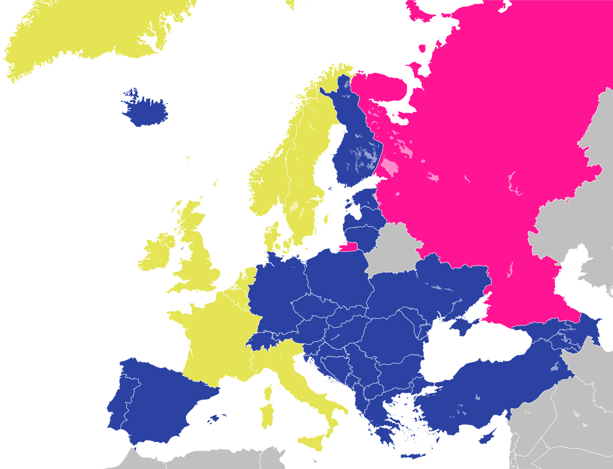
| 21:36 19 ago 2008 |  | 1200 × 1000 (48 kB) | JLogan | {{Information |Description={{en|1=Map of the Council of Europe.<br />{{legend|#e4e454|Founder}}{{legend|#2b42a3|Later member}}}} {{fr|1=Carte du Conseil de l'Europe.<br />{{legend|#e4e454|Fondateurs}}{{legend|#2b42a3|Autres}}}} | |
Usu del ficheru
Nun hai páxines qu'usen esti ficheru.
Usu global del ficheru
Estes otres wikis usen esti ficheru:
- Usu en en.wikipedia.org
- Usu en fr.wikipedia.org
- Usu en hy.wikipedia.org
- Usu en ja.wikipedia.org
- Usu en ru.wikipedia.org