
Ficheru:Carte Lewis and Clark Expedition.png
Tamañu d'esta previsualización: 800 × 520 pixels. Otres resoluciones: 320 × 208 pixels | 640 × 416 pixels | 1024 × 665 pixels | 1513 × 983 pixels.
Ficheru orixinal (1513 × 983 píxels, tamañu de ficheru: 84 kB, triba MIME: image/png)

|
Esta imagen debería volverse a crear como imágenes vectoriales SVG. Esto proporciona muchas ventajas, véase Commons:Media for cleanup (en inglés) para más información. Si ya hay una versión SVG de esta imagen disponible, por favor súbala a Commons. Tras subirla, reemplace esta plantilla con la plantilla
{{vector version available|nuevo nombre de imagen.svg}} en esta imagen. |
Resume
| Descripción |
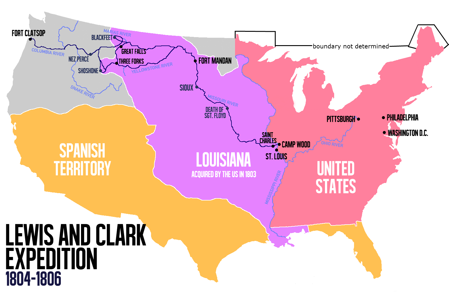
English: Route of the Lewis and Clark Expedition |
| Data | |
| Fonte |
Trabayu propiu, Este archivo deriva de: Carte Lewis-Clark Expedition-en.png |
| Autor | Victor van Werkhooven |
| Otres versiones |
 |
Llicencia
| Yo, el titular de los drechos d'autor d'esta obra, la llibero como dominiu públicu. Esto s'aplica nel mundu ensembre. En dellos países seique esto nun seya posible llegalmente; nesti casu: Doi a cualesquier persona permisu pa usar esta obra pa cualesquier propósitu, ensin denguna condición, menos si eses condiciones requierense pola llei. |
Historial del ficheru
Calca nuna fecha/hora pa ver el ficheru como taba daquella.
| Data/Hora | Miniatura | Dimensiones | Usuariu | Comentariu | |
|---|---|---|---|---|---|
| actual | 14:21 13 xun 2014 | | 1513 × 983 (84 kB) | Nwbeeson | Reverted to version as of 14:18, 13 June 2014 |
| 14:20 13 xun 2014 |  | 1513 × 983 (84 kB) | Nwbeeson | Corrected boundary of the United States. The original left out Maine, Michigan, Wisconsin, and part of Minnesota, none of which were states, but all of which were definitely part of the territory of the United States. | |
| 14:18 13 xun 2014 |  | 1513 × 983 (84 kB) | Nwbeeson | Corrected boundary of the United States. The original left out Maine, Michigan, Wisconsin, and part of Minnesota, none of which were states, but all of which were definitely part of the territory of the United States. | |
| 15:17 22 may 2014 |  | 1513 × 983 (134 kB) | Luctor | User created page with UploadWizard |
Usu del ficheru
La páxina siguiente usa esti ficheru:
Usu global del ficheru
Estes otres wikis usen esti ficheru:
- Usu en bn.wikipedia.org
- Usu en de.wikipedia.org
- Usu en en.wikipedia.org
- Usu en es.wikipedia.org
- Usu en et.wikipedia.org
- Usu en eu.wikipedia.org
- Usu en fa.wikipedia.org
- Usu en gl.wikipedia.org
- Usu en hu.wikipedia.org
- Usu en it.wikipedia.org
- Usu en ko.wikipedia.org
- Usu en ms.wikipedia.org
- Usu en nl.wikipedia.org
- Usu en no.wikipedia.org
- Usu en oc.wikipedia.org
- Usu en pl.wikipedia.org
- Usu en sr.wikipedia.org
- Usu en tr.wikipedia.org
- Usu en www.wikidata.org
- Usu en zh.wikipedia.org