
Ficheru:British Virgin Islands.jpg

Tamañu d'esta previsualización: 800 × 533 pixels. Otres resoluciones: 320 × 213 pixels | 640 × 427 pixels | 1024 × 683 pixels | 1280 × 853 pixels | 2700 × 1800 pixels.
Ficheru orixinal (2700 × 1800 píxels, tamañu de ficheru: 2,89 MB, triba MIME: image/jpeg)
Resume
| Descripción |
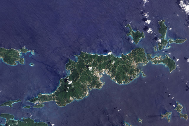
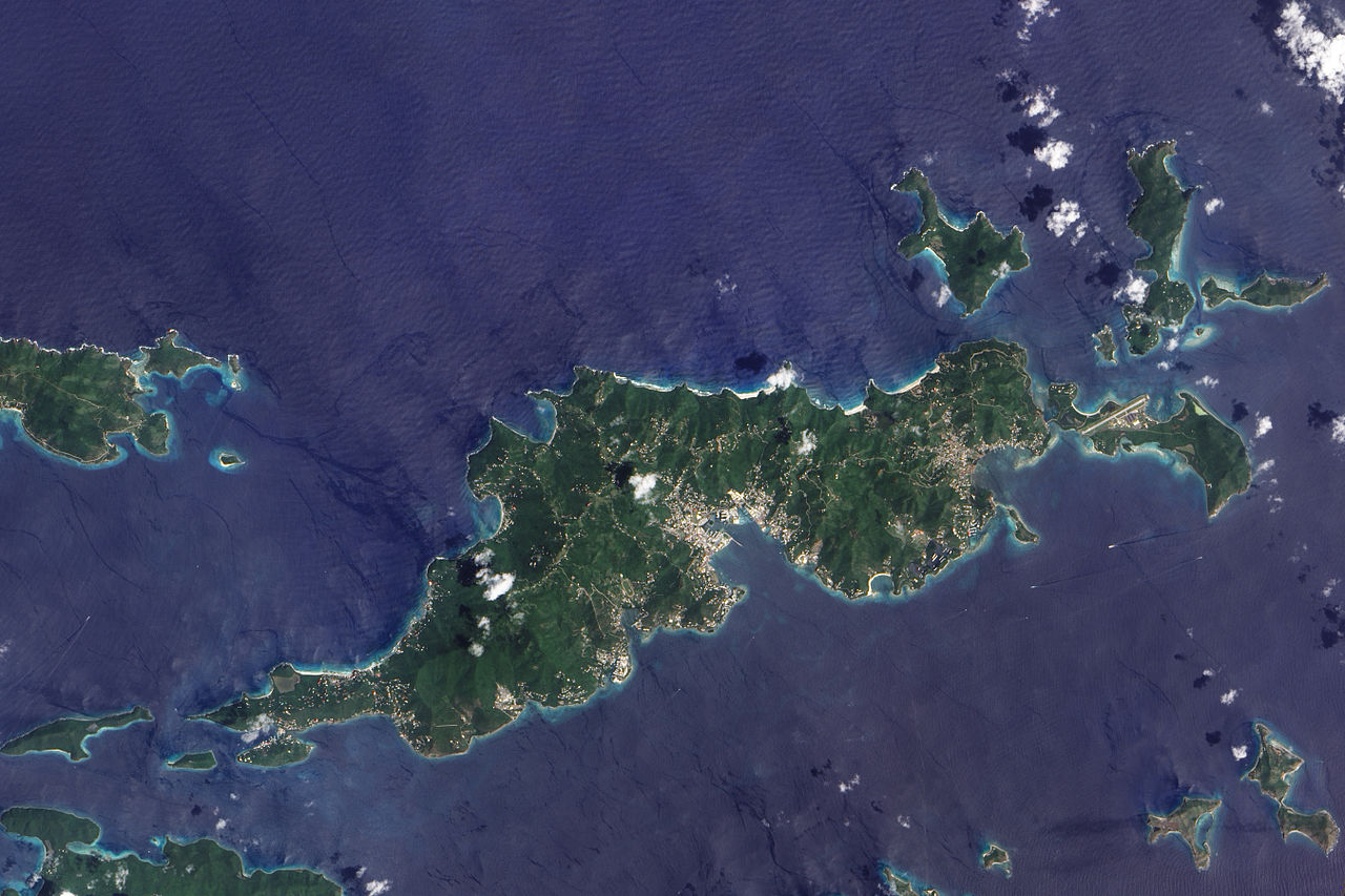
English: This true-colour image of Tortola and its smaller neighbours, Guana Island, Grand Camanoe, and Beef Island. The islands follow a roughly south-west-north-east trajectory. Gray-beige urbanized areas cling to the coast while Tortola’s interior remains mostly green, an arrangement driven by the islands’s topography. The biggest settlement fringes Road Bay. A straight line crossing Beef Island gives away the location of a small airport. Tortola’s carpet of green suggests a lush rainforest, but the island actually supports a patch of drought-resistant forest, in addition to plants accustomed to more water. Tortola’s climate and land surface are well suited to raising livestock, but tourism and financial services are the primary industries. |
| Data | |
| Fonte | NASA Earth Observatory |
| Autor | Jesse Allen |
Image captured by the Advanced Land Imager (ALI) on NASA’s Earth Observing-1 (EO-1) satellite. Image created using EO-1 ALI data provided courtesy of the NASA EO-1 team and the United States Geological Survey. Instrument: EO-1 - ALI.
Llicencia
| Este archivo es de dominio público porque fue creado por la NASA. Las políticas sobre copyright de la NASA estipulan que «el material de la NASA no está protegido con copyright a menos que se indique lo contrario». (Políticas sobre copyright de la NASA o Políticas sobre la utilización de imágenes del Jet Propulsion Laboratory). | ||
 |
Advertencias:
|
| Annotations | This image is annotated: View the annotations at Commons |
Historial del ficheru
Calca nuna fecha/hora pa ver el ficheru como taba daquella.
| Data/Hora | Miniatura | Dimensiones | Usuariu | Comentariu | |
|---|---|---|---|---|---|
| actual | 12:06 30 pay 2009 | | 2700 × 1800 (2,89 MB) | Originalwana | {{Information |Description={{en|1=This true-colour image of Tortola and its smaller neighbours, Guana Island, Grand Camanoe, and Beef Island. The islands follow a roughly south-west-north-east trajectory. Gray-beige urbanized areas c |
Usu del ficheru
La páxina siguiente usa esti ficheru:
Usu global del ficheru
Estes otres wikis usen esti ficheru:
- Usu en af.wikipedia.org
- Usu en ar.wikipedia.org
- Usu en arz.wikipedia.org
- Usu en ca.wikipedia.org
- Usu en cy.wikipedia.org
- Usu en da.wikipedia.org
- Usu en en.wikipedia.org
- Usu en eo.wikipedia.org
- Usu en fr.wikivoyage.org
- Usu en ga.wikipedia.org
- Usu en gl.wikipedia.org
- Usu en ht.wikipedia.org
- Usu en pap.wikipedia.org
- Usu en pl.wikipedia.org
- Usu en ru.wikinews.org
- Usu en tl.wikipedia.org
- Usu en tt.wikipedia.org
- Usu en uk.wikipedia.org
- Usu en vec.wikipedia.org
- Usu en www.wikidata.org