
Ficheru:Behouden Huys in 1881.jpg

Behouden_Huys_in_1881.jpg (728 × 504 píxels, tamañu de ficheru: 197 kB, triba MIME: image/jpeg)
Resume
| Descripción |
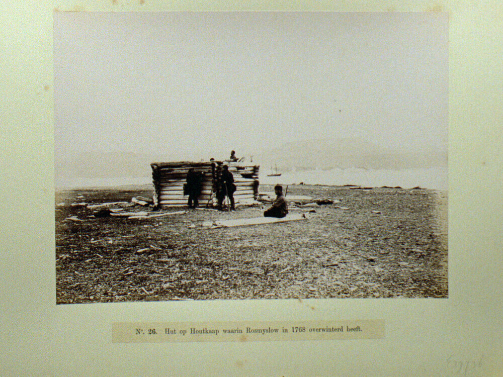
Nederlands: Het Behouden Huys in 1881 tijdens de Nederlandse expeditie naar het gebied tijdens het Eerste Internationale Pooljaar. (Het is de vraag of dit daadwerkelijk het Behouden Huys is. Dat was namelijk 6 m. breed en 10 m. lang en bij de vondst in 1871 al behoorlijk ingestort. Bovendien meldt Zeeberg, J.J. (2007) - p. 87 dat deze expeditie het Behouden Huys niet heeft weten te bereiken.
|
||||||||||||||||||||||||||
| Data | |||||||||||||||||||||||||||
| Fonte | Maritiem Digitaal (direct link) - original description: "Bemanningsleden van de schoener Willem Barentsz, tijdens de reis voor wetenschappelijk onderzoek in de Noordelijke IJszee van 1881, bij de overblijfselen van het 'Behouden Huys' waarin de ontdekkingsreiziger Willem Barentsz in de winter van 1596-1597 overwinterde op Nova Zembla" . | ||||||||||||||||||||||||||
| Autor |
Grant, William J.A. [1851–1935], currently located in the
|
||||||||||||||||||||||||||
.svg)
| Posición de la cámara | | Ubicación de esta y otras imágenes en: OpenStreetMap |
|---|
Llicencia
|
Este material está en dominio público en los demás países donde el derecho de autor se extiende por 80 años (o menos) tras la muerte del autor. Esta obra está en el dominio público en los Estados Unidos porque fue publicada (o registrada con la Oficina del Derecho de Autor de los E.E. U.U.) antes del 1 de enero de 1929. | |
| Esta obra ha sido identificada como libre de las restricciones conocidas en virtud del derecho de autor, incluyendo todos los derechos conexos. | |
Historial del ficheru
Calca nuna fecha/hora pa ver el ficheru como taba daquella.
| Data/Hora | Miniatura | Dimensiones | Usuariu | Comentariu | |
|---|---|---|---|---|---|
| actual | 04:06 13 xun 2022 | | 728 × 504 (197 kB) | Ras67 | cropped and leveled |
| 04:05 13 xun 2022 |  | 1024 × 768 (384 kB) | Ras67 | original scan for archival purpose | |
| 14:22 2 may 2008 |  | 400 × 275 (20 kB) | Hardscarf | {{Information |Description={{nl|Het Behouden Huys in 1881 tijdens de Nederlandse expeditie naar het gebied tijdens het Eerste Internationale Pooljaar}} |Source=[http://www.maritiemdigitaal.nl/ Maritiem Digitaal] - original description: "Bemanningsleden va |
Usu del ficheru
La páxina siguiente usa esti ficheru:
Usu global del ficheru
Estes otres wikis usen esti ficheru:
- Usu en ar.wikipedia.org
- Usu en ca.wikipedia.org
- Usu en de.wikipedia.org
- Usu en es.wikipedia.org
- Usu en fr.wikipedia.org
- Usu en fy.wikipedia.org
- Usu en it.wikipedia.org
- Usu en nl.wikipedia.org
- Usu en pnb.wikipedia.org
- Usu en sl.wikipedia.org