
Ficheru:Bass Islands map.png
Tamañu d'esta previsualización: 484 × 599 pixels. Otres resoluciones: 194 × 240 pixels | 388 × 480 pixels.
Ficheru orixinal (800 × 990 píxels, tamañu de ficheru: 261 kB, triba MIME: image/png)
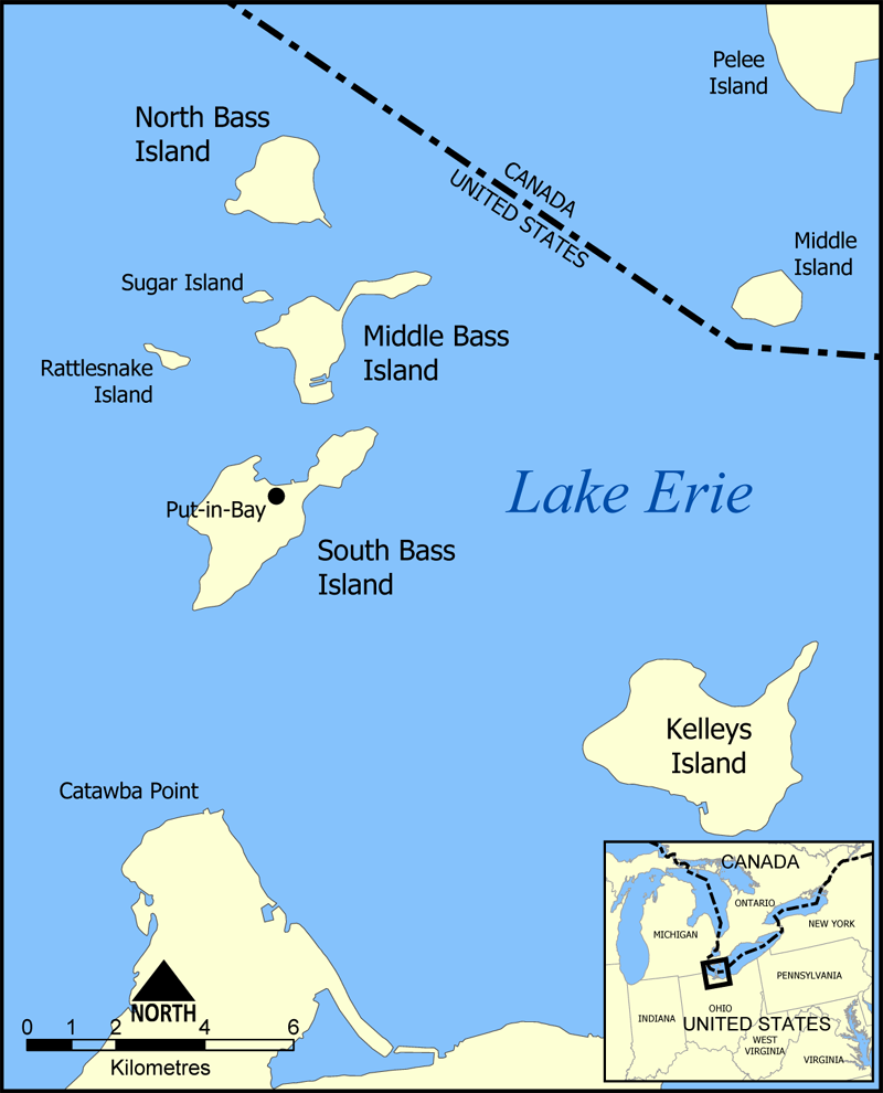
This is a map of the Bass Islands in Lake Erie. The three main islands are South Bass Island, Middle Bass Island, and North Bass Island. As well, the map shows the nearby Kelleys Island, Sugar Island, Rattlesnake Island, and Middle Island.
Created by NormanEinstein, June 23, 2005.
Yo, el titular de los drechos d'autor d'esta obra, la espublizo baxo la siguiente llicencia:

|
Autorízase la copia, distribución y/o cambéu d'esti documentu baxo los términos de la Llicencia de documentación llibre GNU, versión 1.2 o cualesquier otra que nel futuru espublice la Free Software Foundation; ensin seiciones invariables, testos de portada, nin testos de contraportada. S'inclúi una copia de la llicencia na seición titulada GNU Free Documentation License. |
| Esti ficheru ta disponible baxo la llicencia Creative Commons Reconocimientu-Compartir igual 3.0 xenérica. | ||
| ||
| Esta etiqueta de llicencia s'amestó a esti ficheru como parte del anovamientu de la llicencia GFDL. |
Historial del ficheru
Calca nuna fecha/hora pa ver el ficheru como taba daquella.
| Data/Hora | Miniatura | Dimensiones | Usuariu | Comentariu | |
|---|---|---|---|---|---|
| actual | 16:32 23 xun 2005 | | 800 × 990 (261 kB) | NormanEinstein | Corrected boundary line problem. |
| 15:04 23 xun 2005 |  | 800 × 990 (262 kB) | NormanEinstein | This is a map of the Bass Islands in Lake Erie. The three main islands are South Bass Island, Middle Bass Island, and North Bass Island. As well, the map shows the nearby Kelleys Island, Sugar Island, Rattlesnake Island, and Middle Island. Created by Nor |
Usu del ficheru
Nun hai páxines qu'usen esti ficheru.
Usu global del ficheru
Estes otres wikis usen esti ficheru:
- Usu en ceb.wikipedia.org
- Usu en de.wikipedia.org
- Usu en en.wikipedia.org
- Usu en es.wikipedia.org
- Usu en fr.wikipedia.org
- Usu en hu.wikipedia.org
- Usu en nl.wikipedia.org
- Usu en pt.wikipedia.org
- Usu en ro.wikipedia.org
- Usu en uk.wikipedia.org
- Usu en ur.wikipedia.org
- Usu en vi.wikipedia.org
- Usu en www.wikidata.org