
Ficheru:Bangladesh divisions english.png
Tamañu d'esta previsualización: 439 × 599 pixels. Otres resoluciones: 176 × 240 pixels | 500 × 682 pixels.
Ficheru orixinal (500 × 682 píxels, tamañu de ficheru: 19 kB, triba MIME: image/png)
Resume
| Descripción |
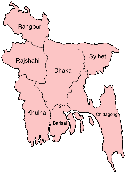
Español: Divisiones de Bangladesh
Map of the divisions of Bangladesh in English. Made by User:Golbez. |
| Data | 31 de avientu de 2005 (fecha original de carga) |
| Fonte | No machine-readable source provided. Own work assumed (based on copyright claims). |
| Autor | No machine-readable author provided. Golbez assumed (based on copyright claims). |
derivative works
Derivative works of this file: Bangladesh location map-Rangpur Division.svg
Llicencia
Yo, la persona titular de los drechos d'autor d'esta obra, espublízola baxo les siguientes llicencies:

|
Autorízase la copia, distribución y/o cambéu d'esti documentu baxo los términos de la Llicencia de documentación llibre GNU, versión 1.2 o cualesquier otra que nel futuru espublice la Free Software Foundation; ensin seiciones invariables, testos de portada, nin testos de contraportada. Inclúise una copia de la llicencia na seición titulada GNU Free Documentation License. |
| Esti ficheru ta disponible baxo la llicencia Creative Commons Reconocimientu-Compartir igual 3.0 xenérica. | ||
| ||
| Esta etiqueta de llicencia s'amestó a esti ficheru como parte del anovamientu de la llicencia GFDL. |
Este archivo está disponible bajo la licencia Creative Commons Reconocimiento 2.5 Genérica.
- Ye llibre:
- pa compartir – pa copiar, distribuir y comunicar públicamente la obra
- pa remezclar – p'adautar la obra
- Baxo les condiciones siguientes:
- reconocimientu – Tienes de dar el créitu apropiáu, apurrir un enllaz a la llicencia ya indicar si realizasti dalgún cambéu. Puedes faelo de cualquier mou razonable ,pero non de manera que suxera l'encontu del autor pa ti o pal usu que faigas.
Pues seleicionar la llicencia que prefieras.
Historial del ficheru
Calca nuna fecha/hora pa ver el ficheru como taba daquella.
| Data/Hora | Miniatura | Dimensiones | Usuariu | Comentariu | |
|---|---|---|---|---|---|
| actual | 19:40 27 xin 2010 | | 500 × 682 (19 kB) | NordNordWest | update Rangpur |
| 00:28 1 mar 2009 |  | 500 × 682 (19 kB) | Mahahahaneapneap | Compressed | |
| 02:52 31 avi 2005 |  | 500 × 682 (20 kB) | Golbez | Map of the divisions of Bangladesh in English. Made by User:Golbez. Category:Maps of Bangladesh |
Usu del ficheru
La páxina siguiente usa esti ficheru:
Usu global del ficheru
Estes otres wikis usen esti ficheru:
- Usu en ar.wikipedia.org
- Usu en ca.wikipedia.org
- Usu en de.wikipedia.org
- Usu en en.wikipedia.org
- Wikipedia:WikiProject Bangladesh
- Wikipedia:WikiProject Bangladesh/History Workgroup
- User:Jonny-mt/Gallery of current first-level administrative country subdivisions maps
- Wikipedia:WikiProject Bangladesh/Geography Workgroup
- Talk:Bangladesh/Archive 3
- Wikipedia:WikiProject Bangladesh/ResourcesBangladesh
- Wikipedia:Graphics Lab/Map workshop/Archive/Aug 2010
- Usu en eo.wikipedia.org
- Usu en fi.wikipedia.org
- Usu en fr.wikipedia.org
- Usu en gl.wikipedia.org
- Usu en hi.wikipedia.org
- बांग्लादेश
- सिलहट विभाग
- चट्टग्राम विभाग
- ढाका जिला
- ढाका विभाग
- राजशाही विभाग
- खुलना विभाग
- बरिशाल विभाग
- नरसिंगडी जिला
- मानिकगंज जिला
- मुंशीगंज जिला
- नारायनगंज जिला
- मैमनसिंह जिला
- शेरपुर जिला
- जमालपुर जिला
- नेत्रोकोना जिला
- गाजीपुर जिला (बांग्लादेश)
- किशोरगंज जिला
- टंगाइल जिला
- फरीदपुर जिला
- मदारीपुर जिला
- शरियतपुर जिला
- राजबाड़ी जिला
- बगेरहाट जिला
- चौडांगा जिला
- येशोर जिला
- झेनईदह जिला
- खुलना जिला
- कुश्तिया जिला
- मगुरा जिला
- मेहरपुर जिला
- नराइल जिला
Ver más usos globales d'esti ficheru.