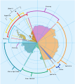
Ficheru:Antarctica, territorial claims.svg
Contenido de la página no disponible en otros idiomas.
De Wikipedia

Ficheru orixinal(ficheru SVG, 820 × 820 píxels nominales, tamañu de ficheru: 72 kB)

Esti ficheru ye de Wikimedia Commons y puen usalu otros proyeutos. La descripción de la páxina de descripción del ficheru s'amuesa darréu.

Descripción
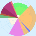
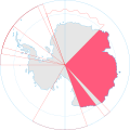
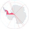
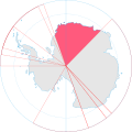
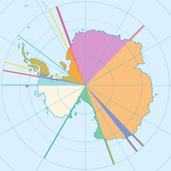
English: Map showing the territorial claims to Antarctica
 
Argentina
 
Australia
 
Chile
 
France
 
New Zealand
 
Norway
 
United Kingdom
  • The claims of Chile, Argentina and the United Kingdom partially overlap (as can be seen from the mixed colours above)
  • Norway claims two territories. Peter I Island (small circle in the top of the unclaimed territory) and Queen Maud Land. Norway has not officially elaborated as to the northernly extent of Queen Maud Land. This is why the Norwegian claim is illustrated differently from the other claims. It is however generally assumed that the Norwegian claim follows the norms of the other Antarctic claims.
  • Brazilian Antarctica (Brazil's unofficial claim) and New Swabia (Nazi Germany's historical claim) are both marked out in the code of the image but has not been coloured in. (New Swabia is lacking northernly and southernly borders on the map though)
Data
Fonte
Autor Lokal_Profil
Permisu
(Cómo reutilizar esti ficheru)
w:es:Creative Commons
reconocimientu compartir igual
Este archivo se encuentra bajo la licencia Creative Commons Genérica de Atribución/Compartir-Igual 2.5.
Reconocimientu: Lokal_Profil
Ye llibre:
  • pa compartir – pa copiar, distribuir y comunicar públicamente la obra
  • pa remezclar – p'adautar la obra
Baxo les condiciones siguientes:
  • reconocimientu – Tienes de dar el créitu apropiáu, apurrir un enllaz a la llicencia ya indicar si realizasti dalgún cambéu. Puedes faelo de cualquier mou razonable ,pero non de manera que suxera l'encontu del autor pa ti o pal usu que faigas.
  • compartir igual – Si entemeces, tresformes o te bases nesti material, tienes de distribuir les tos contribuciones baxo la mesma llicencia o una compatible cola orixinal.
Otres versiones

Pies

Añade una explicación corta acerca de lo que representa este archivo
Map showing the territorial claims to Antarctica

Elementos representados en este archivo

representa a

tipo de archivo español

image/svg+xml

db1a74e155cb9d4c2518fd777511c1c5701186a6

73 320 Byte

820 píxel

820 píxel

Historial del ficheru

Calca nuna fecha/hora pa ver el ficheru como taba daquella.

Data/HoraMiniaturaDimensionesUsuariuComentariu
actual16:42 8 may 2020Miniatura de la versión a fecha de 16:42 8 may 2020820 × 820 (72 kB)Spesh531Norway's claim stretches to the South Pole as of June 12 2015
04:31 13 och 2009Miniatura de la versión a fecha de 04:31 13 och 2009820 × 820 (71 kB)DooFisauerkraut
20:08 30 xun 2008Miniatura de la versión a fecha de 20:08 30 xun 2008806 × 806 (43 kB)Lokal Profil{{Information |Description={{en|Map showing the territorial claims to Antarctica}} {{legend|#e987eb|New Zealand}} {{legend|#fcc475|Australia}} {{legend|#8282ed|France}} {{legend|#7efa72|Norway}} {{legend|#ec787f|United Kingdom}} {{legend|#6db87f|Chile}} {

La páxina siguiente usa esti ficheru:

Usu global del ficheru

Estes otres wikis usen esti ficheru:

Ver más usos globales d'esti ficheru.

Metadatos