
Ficheru:Alcazaba in Alhambra, Granada (7076755831).jpg
Ficheru orixinal (3739 × 2483 píxels, tamañu de ficheru: 6,36 MB, triba MIME: image/jpeg)
.jpg)
Resume
| Descripción |
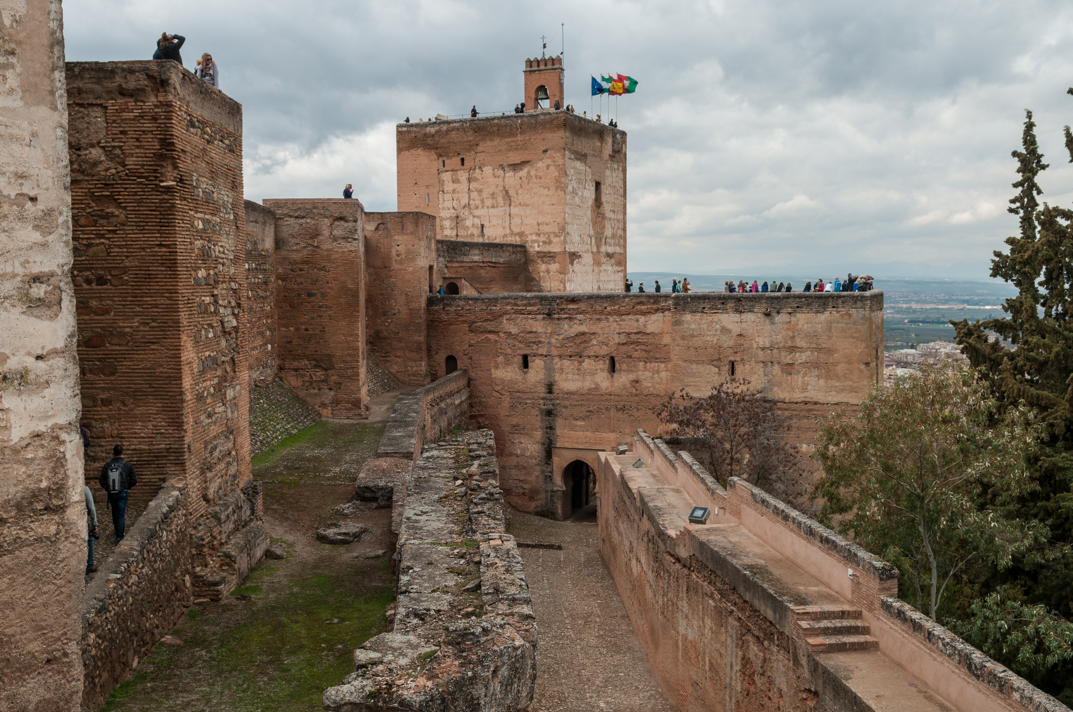
Alhambra, the complete form of which was Calat Alhambra (الْقَلْعَةُ ٱلْحَمْرَاءُ, trans. al-Qal‘at al-Ḥamrā’, "the red fortress"), is a palace and fortress complex located in Granada, Andalusia, Spain. It was constructed during the mid 14th century by the Moorish rulers of the Emirate of Granada in al-Andalus, occupying the top of the hill of the Assabica on the southeastern border of the city of Granada. The Alhambra's Moorish palaces were built for the last Muslim Emirs in Spain and its court, of the Nasrid dynasty. After the Reconquista (reconquest) by the Reyes Católicos ("Catholic Monarchs") in 1492, some portions were used by the Christian rulers. The Palace of Charles V, built by Charles V, Holy Roman Emperor in 1527, was inserted in the Alhambra within the Nasrid fortifications. After being allowed to fall into disrepair for centuries, the Alhambra was "discovered" in the 19th century by European scholars and travelers, with restorations commencing. It is now one of Spain's major tourist attractions, exhibiting the country's most significant and well known Islamic architecture, together with 16th-century and later Christian building and garden interventions. The Alhambra is a UNESCO World Heritage Site, and the inspiration for many songs and stories. Alhambra. (2012, April 10). In Wikipedia, The Free Encyclopedia. Retrieved 15:33, April 14, 2012, from en.wikipedia.org/w/index.php?title=Alhambra&oldid=486... |
| Data | |
| Fonte | Alcazaba in Alhambra, Granada |
| Autor | Michal Osmenda from Brussels, Belgium |
| Posición de la cámara | | Ubicación de esta y otras imágenes en: OpenStreetMap |
|---|
.jpg¶ms=037.177047_N_-003.591617_E_globe:Earth_type:camera_source:Flickr_&language=ast)
Llicencia
- Ye llibre:
- pa compartir – pa copiar, distribuir y comunicar públicamente la obra
- pa remezclar – p'adautar la obra
- Baxo les condiciones siguientes:
- reconocimientu – Tienes de dar el créitu apropiáu, apurrir un enllaz a la llicencia ya indicar si realizasti dalgún cambéu. Puedes faelo de cualquier mou razonable ,pero non de manera que suxera l'encontu del autor pa ti o pal usu que faigas.
| Esta imagen, originalmente subida a Flickr, fue revisada el 3 de febrero de 2013 por el administrador o revisor File Upload Bot (Magnus Manske), quien comprobó que el archivo se encontraba disponible en Flickr bajo la licencia nombrada en dicha fecha. |
Historial del ficheru
Calca nuna fecha/hora pa ver el ficheru como taba daquella.
| Data/Hora | Miniatura | Dimensiones | Usuariu | Comentariu | |
|---|---|---|---|---|---|
| actual | 03:37 3 feb 2013 | | 3739 × 2483 (6,36 MB) | File Upload Bot (Magnus Manske) | Transferred from Flickr by User:russavia |
Usu del ficheru
La páxina siguiente usa esti ficheru:
Usu global del ficheru
Estes otres wikis usen esti ficheru:
.jpg)