Saint-Victor-sur-Avre
Apariencia
 | |
| Alministración | |
| País | |
| Organización territorial | Francia metropolitana |
| Rexón | |
| Departamentu | Eure |
| Tipu d'entidá | comuña de Francia |
| Nome oficial | Saint-Victor-sur-Avre (fr)[1] |
| Códigu postal |
27130 |
| Xeografía | |
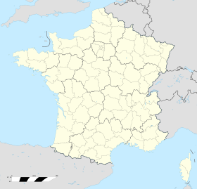
| Coordenaes | 48°42′09″N 0°51′20″E / 48.7025°N 0.8556°E |
 | |
| Superficie | 6.9 km² |
| Altitú | 167 m[2] y 206 m[2] |
| Llenda con | Pullay, Verneuil d'Avre et d'Iton, Boissy-lès-Perche, Rohaire, Armentières-sur-Avre y Saint-Christophe-sur-Avre |
| Demografía | |
| Población |
55 hab. (1r xineru 2021) - 29 homes (2017) - 29 muyeres (2017) |
| Porcentaxe | 0.01% de Eure |
| Densidá | 7,97 hab/km² |
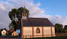
Saint-Victor-sur-Avre ye una comuña francesa del departamentu d'Eure, na rexón de Normandía. Llenda con Pullay, Verneuil d'Avre et d'Iton, Boissy-lès-Perche, Rohaire, Armentières-sur-Avre y Saint-Christophe-sur-Avre.
Tien una población de 55 hab. (1 xineru 2021)[3][4] y una superficie de 6,9[5] km².
Referencies
[editar | editar la fonte]- ↑ «code officiel géographique». Consultáu'l 6 xineru 2019.
- ↑ 2,0 2,1 Tienes d'especificar urlarchivu = y fechaarchivu = al usar {{cita web}}.«répertoire géographique des communes». Institut national de l'information géographique et forestière (2015).
- ↑ Afirmao en: Populations légales 2021. Data d'espublización: 28 avientu 2023. Editorial: Institut national de la statistique et des études économiques.
- ↑ censu de población
- ↑ Afirmao en: répertoire géographique des communes. Data de consulta: 26 ochobre 2015. Editorial: Institut national de l'information géographique et forestière.

