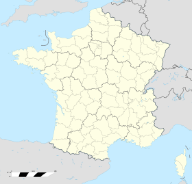
Sentheim
 | |||
| |||
| Alministración | |||
| País | |||
| Organización territorial | Francia metropolitana | ||
| Rexón | |||
| Departamentu | Altu Rin | ||
| Tipu d'entidá | comuña de Francia | ||
| Nome oficial | Sentheim (fr)[1] | ||
| Códigu postal |
68780 | ||
| Xeografía | |||
| Coordenaes | 47°45′18″N 7°03′04″E / 47.755°N 7.0511°E | ||
 | |||
| Superficie | 6.18 km² | ||
| Llenda con | Bourbach-le-Bas, Lauw, Guewenheim, Soppe-le-Haut, Mortzwiller y Le Haut-Soultzbach | ||
| Demografía | |||
| Población |
1548 hab. (1r xineru 2021) - 767 homes (2017) - 810 muyeres (2017) | ||
| Porcentaxe |
0.2% de Altu Rin 0.03% de Gran Este 0% de Francia metropolitana 0% de Francia | ||
| Densidá | 250,49 hab/km² | ||
| Más información | |||
| Estaya horaria |
UTC+01:00 (horariu estándar) UTC+02:00 (horariu de branu) | ||
| sentheim.fr | |||
Sentheim ye una llocalidá y comuña francesa, asitiada nel departamentu d'Altu Rin, na rexón d'Alsacia.
Referencies[editar | editar la fonte]
- ↑ «code officiel géographique». Consultáu'l 6 xineru 2019.
Enllaces esternos[editar | editar la fonte]
- Sentheim nel Institutu xeograficu nacional
- Sentheim, informaciones xenerales nel sitiu quid.fr
- Planu de Sentheim en Mapquest


